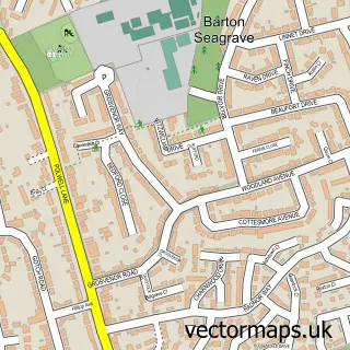
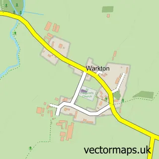
This Burton Latimer street map is a detailed vector street map covering a 750m x 750m area. Select a larger area to create and download your own vector street map of Burton Latimer.
The 750-metre map sample for Burton Latimer covers 543 mapped buildings and approximately 30.2 km of road detail, of which 43 named roads are named. The immediate area includes 1 school, 1 GP surgery within 2 miles, 2 pubs and 1 MOT station, with 5 within 2 miles. The wider area around Burton Latimer features 6 food and drink venues and 1 campsite within 2 miles. To create a larger or custom map of Burton Latimer, the map builder lets you define your own coverage area and download editable SVG, PDF and PNG files.
Create a larger editable map of Burton Latimer
Choose any area you need and generate a high-quality vector map instantly. Perfect for print, planning, design, business and personal use.

This Burton Latimer street map in Northamptonshire is available as downloadable SVG, PDF and PNG map files, or as a printed map for planning, business, display, education, local information and design work. You can also create a larger custom map area using the map selector.
What this Burton Latimer map sample shows
Burton Latimer lies within Burton Latimer Cp parish, part of Burton Latimer ward in the North Northamptonshire local authority area. The postcode geography for this area includes the NN postcode area, the NN15 postcode district and the NN15 5 postcode sector. Residents fall under the Nhs Northamptonshire Integrated Care Board for NHS services.
Local features near Burton Latimer
Within 2 milesAmenities and services in and around Burton Latimer.
Administrative and postcode information for Burton Latimer
The local authority covering Burton Latimer is North Northamptonshire, within the county of Northamptonshire. The settlement lies within Burton Latimer ward and Burton Latimer Cp civil parish. The NN15 postcode district and NN15 5 postcode sector serve the immediate area. NHS provision in the area is delivered through Kettering General Hospital Nhs Foundation Trust.
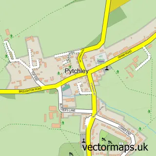
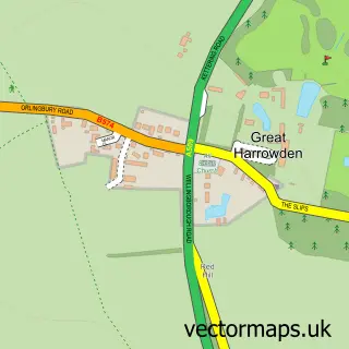
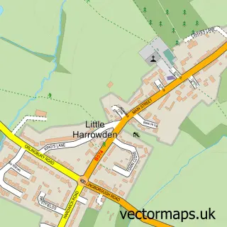
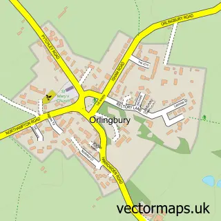
Nearby street map samples around Burton Latimer

More street maps in Northamptonshire
750 metre map area coverage
Boundary, postcode and point of interest information for the 750m x 750m rectangle centred on this sample map.
Boundaries containing map centre
Constituency: Kettering Co Const
District: North Northamptonshire
Icb: NHS Northamptonshire ICB
Parish: Burton Latimer CP
Police Force: northamptonshire
Postcode District: NN15
Postcode Sector: NN15 5
Ward: Barton Seagrave & Burton Latimer Ward
Nearby boundaries intersecting sample
No additional intersecting boundaries found.
Postcode coverage
POI category counts
Beauty Salon: 9
Automotive Repair: 6
Hair Salon: 5
Barber: 4
Indian Restaurant: 4
Professional Services: 4
Social Service Organizations: 4
Church Cathedral: 3
Convenience Store: 3
Pizza Restaurant: 3
Sample points of interest
- Corby Kilns
- Wongs
- The Yews Residential Home For The Elderly
- Latimer Equipment Services Ltd.
- Bee Cool
- Asap Recovery Services
- Burton Latimer Car Care
- Citycall Services
- H S Motors
- I M Kelly Automotive
- Kwik-Nick Motors
- Jollytots
Create a larger editable map of Burton Latimer
This sample shows only a 750 metre area. To create a larger map of Burton Latimer, use our map builder to choose your own coverage area, add titles and download editable SVG, PDF and PNG files.
Create a custom map of Burton Latimer