Vector Maps logo
Home Why it works Popular maps Districts Samples Customizer Create Your Map
VectorMaps.uk
Home Popular maps Districts Samples Customizer Create Your Map Privacy Disclaimer
Home / UK Maps / Northamptonshire / Isham Map

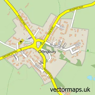
This Isham street map is a detailed vector street map covering a 750m x 750m area. Select a larger area to create and download your own vector street map of Isham.

Isham is a village in Northamptonshire, in the East Midlands of England. The settlement falls within the Wellingborough parliamentary constituency. It is served by the NN14 postcode district, with NN14 1 as the local postcode sector.

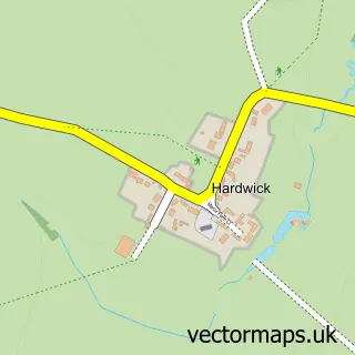
The 750-metre map sample for Isham covers 249 mapped buildings and approximately 18.0 km of road detail, of which 16 named roads are named. The immediate area includes 1 school, 1 GP surgery within 2 miles, 1 pub and 6 MOT stations within 2 miles. The wider area around Isham features 1 food and drink venue. To create a larger or custom map of Isham, the map builder lets you define your own coverage area and download editable SVG, PDF and PNG files.

249Buildings
17.99 kmRoads
16Named roads
8,882Residents within 2 miles
Create your own

Create a larger editable map of Isham

Choose any area you need and generate a high-quality vector map instantly. Perfect for print, planning, design, business and personal use.

Choose any location
Editable SVG files
Any size up to A0
PDF, PNG & more
Instant download
High quality guaranteed
Create My Custom Map
Secure, private & no credit card required
Isham Vector Street Map
750m Sample
Isham vector street map sample showing roads, buildings and local features in a 750 metre preview area
Buy Isham Map Print from £12.95 Buy Isham Digital Map from £6

This Isham street map in Northamptonshire is available as downloadable SVG, PDF and PNG map files, or as a printed map for planning, business, display, education, local information and design work. You can also create a larger custom map area using the map selector.

What this Isham map sample shows

Isham lies within Isham Cp parish, part of Harrowden & Sywell ward in the North Northamptonshire local authority area. The postcode geography for this area includes the NN postcode area, the NN14 postcode district and the NN14 1 postcode sector. Residents fall under the Nhs Northamptonshire Integrated Care Board for NHS services.

Local features near Isham

Within 2 miles

Amenities and services in and around Isham.

1 Schools
1 GP surgeries within 2 miles
6 MOT stations within 2 miles
1 Food & drink
1 Pubs

Counts are approximate and based on publicly available data.

Administrative and postcode information for Isham

The local authority covering Isham is North Northamptonshire, within the county of Northamptonshire. The settlement lies within Harrowden & Sywell ward and Isham Cp civil parish. The NN14 postcode district and NN14 1 postcode sector serve the immediate area. NHS provision in the area is delivered through Kettering General Hospital Nhs Foundation Trust.

Parish Isham CP
Ward Harrowden & Sywell
District / local authority North Northamptonshire
County Northamptonshire
Historic county Northamptonshire
Postcode district NN14
Postcode sector NN14 1
Parliamentary constituency Wellingborough
Region East Midlands
Country England

Nearby street map samples around Isham

Street map sample of Burton Latimer, Northamptonshire Burton Latimer Town - Northamptonshire - 1.2 miles Street map sample of Milton Keynes, Buckinghamshire Milton Keynes City - Buckinghamshire - 22.0 miles Street map sample of Barton Seagrave, Northamptonshire Barton Seagrave Village - Northamptonshire - 1.6 miles Street map sample of Pytchley, Northamptonshire Pytchley Village - Northamptonshire - 1.6 miles Street map sample of Little Harrowden, Northamptonshire Little Harrowden Village - Northamptonshire - 1.7 miles Street map sample of Orlingbury, Northamptonshire Orlingbury Village - Northamptonshire - 1.8 miles Street map sample of Great Harrowden, Northamptonshire Great Harrowden Village - Northamptonshire - 2.0 miles Street map sample of Cranford St. Andrew, Northamptonshire Cranford St. Andrew Village - Northamptonshire - 3.1 miles Street map sample of Cranford St. John, Northamptonshire Cranford St. John Village - Northamptonshire - 3.3 miles Street map sample of Hardwick, Northamptonshire Hardwick Village - Northamptonshire - 3.3 miles

More street maps in Northamptonshire

Street map sample of Burton Latimer, Northamptonshire Burton Latimer Town - 1.2 miles Street map sample of Barton Seagrave, Northamptonshire Barton Seagrave Village - 1.6 miles Street map sample of Pytchley, Northamptonshire Pytchley Village - 1.6 miles Street map sample of Little Harrowden, Northamptonshire Little Harrowden Village - 1.7 miles Street map sample of Orlingbury, Northamptonshire Orlingbury Village - 1.8 miles

750 metre map area coverage

Boundary, postcode and point of interest information for the 750m x 750m rectangle centred on this sample map.

Boundaries containing map centre

Constituency: Daventry Co Const

District: North Northamptonshire

Icb: NHS Northamptonshire ICB

Parish: Isham CP

Police Force: northamptonshire

Postcode District: NN14

Postcode Sector: NN14 1

Ward: Earls Barton Ward

Nearby boundaries intersecting sample

No additional intersecting boundaries found.

Postcode coverage

NN14 NN14 1

POI category counts

Charity Organization: 2

Elementary School: 2

Anglican Church: 1

Bakery: 1

Building Supply Store: 1

Business: 1

Car Dealer: 1

Church Cathedral: 1

Driving School: 1

Event Planning: 1

Sample points of interest

  • St Peter Anglican Church
  • JLR Baked Kreation Bakery
  • GNG Biddle Building Supply Store
  • Jenny Hall Business
  • Motorzone Kettering Car Dealer
  • FOIS - Friends of Isham School Charity Organization
  • Parkinsons Disease Society Charity Organization
  • St Peters Church Church Cathedral
  • Wendy's Driver Training Driving School
  • Isham C of E Primary School Elementary School
  • Isham CEVA Primary School Elementary School
  • Divine Elemental Wellbeing Hub Event Planning

Create a larger editable map of Isham

This sample shows only a 750 metre area. To create a larger map of Isham, use our map builder to choose your own coverage area, add titles and download editable SVG, PDF and PNG files.

Create a custom map of Isham

Phone 01751 473136 | Copyright Vectormaps.uk 2026

Samples Customizer Privacy Disclaimer
Isham Vector Street Map
Isham enlarged street map sample showing a 750 metre preview area