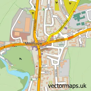
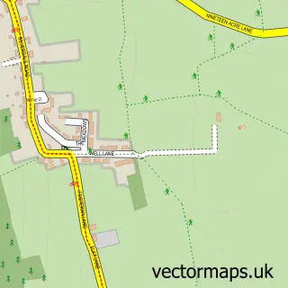
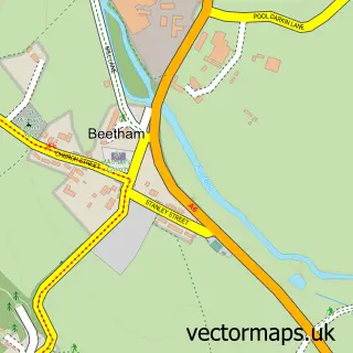
This Burton-in-Kendal street map is a detailed vector street map covering a 750m x 750m area. Select a larger area to create and download your own vector street map of Burton-in-Kendal.
The 750-metre map sample for Burton-in-Kendal covers 318 mapped buildings and approximately 11.0 km of road detail, of which 20 named roads are named. The immediate area includes 1 school and 2 MOT stations within 2 miles. The wider area around Burton-in-Kendal features 2 hotels. To create a larger or custom map of Burton-in-Kendal, the map builder lets you define your own coverage area and download editable SVG, PDF and PNG files.
Create a larger editable map of Burton-in-Kendal
Choose any area you need and generate a high-quality vector map instantly. Perfect for print, planning, design, business and personal use.

This Burton-in-Kendal street map in Cumbria is available as downloadable SVG, PDF and PNG map files, or as a printed map for planning, business, display, education, local information and design work. You can also create a larger custom map area using the map selector.
What this Burton-in-Kendal map sample shows
Burton-in-Kendal lies within Burton-In-Kendal Cp parish, part of Burton & Crooklands ward in the Westmorland And Furness local authority area. The postcode geography for this area includes the LA postcode area, the LA6 postcode district and the LA6 1 postcode sector. Residents fall under the Nhs Lancashire And South Cumbria Integrated Care Board for NHS services.
Local features near Burton-in-Kendal
Within 2 milesAmenities and services in and around Burton-in-Kendal.
Administrative and postcode information for Burton-in-Kendal
The local authority covering Burton-in-Kendal is Westmorland And Furness, within the county of Cumbria. The settlement lies within Burton & Crooklands ward and Burton-In-Kendal Cp civil parish. The LA6 postcode district and LA6 1 postcode sector serve the immediate area. NHS provision in the area is delivered through University Hospitals Of Morecambe Bay Nhs Foundation Trust.
Nearby street map samples around Burton-in-Kendal

More street maps in Cumbria
750 metre map area coverage
Boundary, postcode and point of interest information for the 750m x 750m rectangle centred on this sample map.
Boundaries containing map centre
Constituency: Morecambe and Lunesdale Co Const
District: Westmorland and Furness
Icb: NHS Lancashire and South Cumbria ICB
Parish: Burton-in-Kendal CP
Police Force: cumbria
Postcode District: LA6
Postcode Sector: LA6 1
Ward: Burton and Holme Ward
Nearby boundaries intersecting sample
No additional intersecting boundaries found.
Postcode coverage
POI category counts
Hotel: 2
Building Contractor: 1
Business Consulting: 1
Business Management Services: 1
Community Center: 1
Community Services Non Profits: 1
Convenience Store: 1
Currency Exchange: 1
Driving School: 1
Elementary School: 1
Sample points of interest
- The Bay Blind Co
- Buffin Leadership International
- TAIG Solutions Ltd.
- Burton Memorial Hall
- Burton Recreation Trust
- Burton Village Store
- Post Office Travel Money
- Freedom Driving School
- Burton Morewood School
- R a Thompson Haulage
- Dalton Woodland Burial Grounds
- Esso
Create a larger editable map of Burton-in-Kendal
This sample shows only a 750 metre area. To create a larger map of Burton-in-Kendal, use our map builder to choose your own coverage area, add titles and download editable SVG, PDF and PNG files.
Create a custom map of Burton-in-Kendal