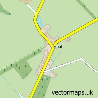
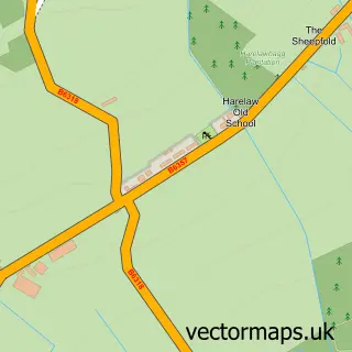
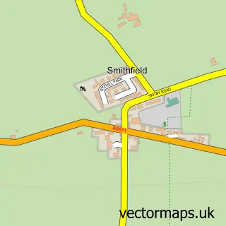
This Canonbie street map is a detailed vector street map covering a 750m x 750m area. Select a larger area to create and download your own vector street map of Canonbie.
The 750-metre map sample for Canonbie covers 157 mapped buildings and approximately 17.1 km of road detail, of which 7 named roads are named. The immediate area includes 1 GP surgery. The wider area around Canonbie features 2 hotels. To create a larger or custom map of Canonbie, the map builder lets you define your own coverage area and download editable SVG, PDF and PNG files.
Create a larger editable map of Canonbie
Choose any area you need and generate a high-quality vector map instantly. Perfect for print, planning, design, business and personal use.

This Canonbie street map in Dumfries is available as downloadable SVG, PDF and PNG map files, or as a printed map for planning, business, display, education, local information and design work. You can also create a larger custom map area using the map selector.
What this Canonbie map sample shows
Canonbie lies within Dumfries And Galloway parish, part of Annandale East And Eskdale ward in the Dumfries And Galloway local authority area. The postcode geography for this area includes the DG postcode area, the DG14 postcode district and the DG14 0 postcode sector. Residents fall under the Dumfries And Galloway for NHS services.
Local features near Canonbie
Within 2 milesAmenities and services in and around Canonbie.
Administrative and postcode information for Canonbie
Canonbie lies within Dumfries And Galloway parish, part of Annandale East And Eskdale ward in the Dumfries And Galloway local authority area. The postcode geography for this area includes the DG postcode area, the DG14 postcode district and the DG14 0 postcode sector. Residents fall under the Dumfries And Galloway for NHS services.
Nearby street map samples around Canonbie

More street maps in Dumfries
750 metre map area coverage
Boundary, postcode and point of interest information for the 750m x 750m rectangle centred on this sample map.
Boundaries containing map centre
Constituency: Dumfriesshire, Clydesdale and Tweeddale Co Const
District: Dumfries and Galloway
Icb: Dumfries and Galloway
Postcode District: DG14
Postcode Sector: DG14 0
Ward: Annandale East and Eskdale Ward
Nearby boundaries intersecting sample
No additional intersecting boundaries found.
Postcode coverage
POI category counts
Hotel: 2
Post Office: 2
Beauty And Spa: 1
Church Cathedral: 1
Contractor: 1
Doctor: 1
Horse Riding: 1
Sample points of interest
- The Dumfriesshire Soap Company
- Canonbie United Parish Church
- Thomson's Decorating Services
- Canonbie Surgery
- Woodhead farm and livery
- Cross Keys Hotel
- Cross Keys Hotel
- Canonbie Post Office
- Canonbie Post Office
Create a larger editable map of Canonbie
This sample shows only a 750 metre area. To create a larger map of Canonbie, use our map builder to choose your own coverage area, add titles and download editable SVG, PDF and PNG files.
Create a custom map of Canonbie