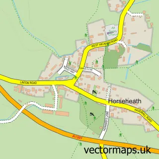
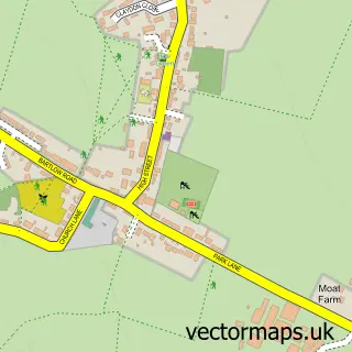
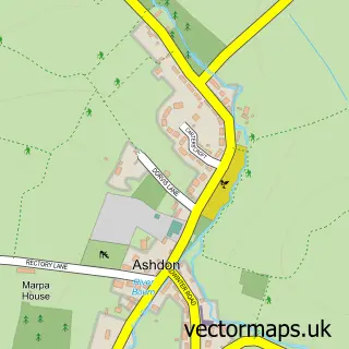
This Cardinal's Green street map is a detailed vector street map covering a 750m x 750m area. Select a larger area to create and download your own vector street map of Cardinal's Green.
The 750-metre map sample for Cardinal's Green covers 73 mapped buildings and approximately 5.6 km of road detail, of which 2 named roads are named. The wider area around Cardinal's Green features 1 tourism point of interest. To create a larger or custom map of Cardinal's Green, the map builder lets you define your own coverage area and download editable SVG, PDF and PNG files.
Create a larger editable map of Cardinal's Green
Choose any area you need and generate a high-quality vector map instantly. Perfect for print, planning, design, business and personal use.

This Cardinal's Green street map in Cambridgeshire is available as downloadable SVG, PDF and PNG map files, or as a printed map for planning, business, display, education, local information and design work. You can also create a larger custom map area using the map selector.
What this Cardinal's Green map sample shows
Cardinal's Green lies within Horseheath Cp parish, part of Balsham ward in the South Cambridgeshire District local authority area. The postcode geography for this area includes the CB postcode area, the CB21 postcode district and the CB21 4 postcode sector. Residents fall under the Nhs Cambridgeshire And Peterborough Integrated Care Board for NHS services.
Local features near Cardinal's Green
Within 2 milesAmenities and services in and around Cardinal's Green.
Administrative and postcode information for Cardinal's Green
Cardinal's Green lies within Horseheath Cp parish, part of Balsham ward in the South Cambridgeshire District local authority area. The postcode geography for this area includes the CB postcode area, the CB21 postcode district and the CB21 4 postcode sector. Residents fall under the Nhs Cambridgeshire And Peterborough Integrated Care Board for NHS services.
Nearby street map samples around Cardinal's Green

More street maps in Cambridgeshire
750 metre map area coverage
Boundary, postcode and point of interest information for the 750m x 750m rectangle centred on this sample map.
Boundaries containing map centre
Constituency: South Cambridgeshire Co Const
County: Cambridgeshire County
District: South Cambridgeshire District
Icb: NHS Central East ICB
Parish: Horseheath CP
Police Force: cambridgeshire
Postcode District: CB21
Postcode Sector: CB21 4
Ward: Balsham Ward
Nearby boundaries intersecting sample
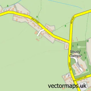
Parish: Shudy Camps CP
Ward: Linton Ward
Postcode coverage
POI category counts
Beverage Store: 1
Health And Medical: 1
Hunting And Fishing Supplies: 1
Landmark And Historical Building: 1
Pet Store: 1
Used Car Dealer: 1
Sample points of interest
- Olive Branch Catering Equipment
- Thought Field Therapy
- The Carp Barn
- Cardinals Green
- Prior's Pet Products
- Brooklands Car Company
Create a larger editable map of Cardinal's Green
This sample shows only a 750 metre area. To create a larger map of Cardinal's Green, use our map builder to choose your own coverage area, add titles and download editable SVG, PDF and PNG files.
Create a custom map of Cardinal's Green