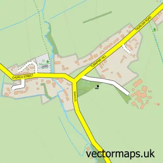
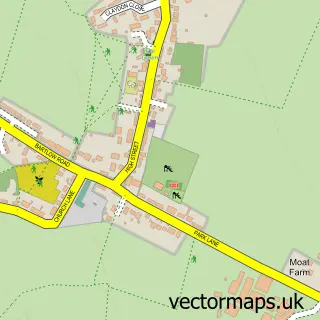
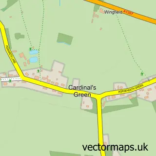
This Haverhill street map is a detailed vector street map covering a 750m x 750m area. Select a larger area to create and download your own vector street map of Haverhill.
The 750-metre map sample for Haverhill covers 374 mapped buildings and approximately 18.3 km of road detail, of which 47 named roads are named. The immediate area includes 1 school, 1 GP surgery, with 2 within 2 miles, 6 pubs and 9 MOT stations within 2 miles. The wider area around Haverhill features 1 tourism point of interest, 19 food and drink venues and 1 hotel. To create a larger or custom map of Haverhill, the map builder lets you define your own coverage area and download editable SVG, PDF and PNG files.
Create a larger editable map of Haverhill
Choose any area you need and generate a high-quality vector map instantly. Perfect for print, planning, design, business and personal use.

This Haverhill street map in Suffolk is available as downloadable SVG, PDF and PNG map files, or as a printed map for planning, business, display, education, local information and design work. You can also create a larger custom map area using the map selector.
What this Haverhill map sample shows
Haverhill lies within Haverhill Cp parish, part of Haverhill North ward in the West Suffolk District local authority area. The postcode geography for this area includes the CB postcode area, the CB9 postcode district and the CB9 9 postcode sector. Residents fall under the Nhs Suffolk And North East Essex Integrated Care Board for NHS services.
Local features near Haverhill
Within 2 milesAmenities and services in and around Haverhill.
Administrative and postcode information for Haverhill
The local authority covering Haverhill is West Suffolk District, within the county of Suffolk. The settlement lies within Haverhill North ward and Haverhill Cp civil parish. The CB9 postcode district and CB9 9 postcode sector serve the immediate area. NHS provision in the area is delivered through Cambridge University Hospitals Nhs Foundation Trust.
Nearby street map samples around Haverhill

More street maps in Suffolk
750 metre map area coverage
Boundary, postcode and point of interest information for the 750m x 750m rectangle centred on this sample map.
Boundaries containing map centre
Constituency: West Suffolk Co Const
County: Suffolk County
District: West Suffolk District
Icb: NHS Essex ICB
Parish: Haverhill CP
Police Force: suffolk
Postcode District: CB9
Postcode Sector: CB9 9
Ward: Haverhill Central Ward
Nearby boundaries intersecting sample
Postcode Sector: CB9 0, CB9 8
Ward: Haverhill East Ward, Haverhill North Ward, Haverhill South Ward
Postcode coverage
POI category counts
Beauty Salon: 9
Charity Organization: 9
Real Estate Agent: 8
Financial Service: 7
Cafe: 6
Clothing Store: 6
Hair Salon: 6
Pub: 6
Accountant: 5
Banks: 5
Sample points of interest
- Essty Accountants
- Hackett Griffey
- Hammond & Hackett
- Jacobs Allen
- Scrutton Bland (Formerly Jacobs Allen)
- Mini Athletics Kingston and Wimbledon
- Skills Matter
- Haverhill Ambulance Station
- Hughes
- Jordan & Bateman Architects
- The Craft Basket
- The Hearing Care Partnership
Create a larger editable map of Haverhill
This sample shows only a 750 metre area. To create a larger map of Haverhill, use our map builder to choose your own coverage area, add titles and download editable SVG, PDF and PNG files.
Create a custom map of Haverhill