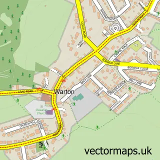
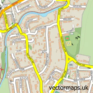
This Carnforth street map is a detailed vector street map covering a 750m x 750m area. Select a larger area to create and download your own vector street map of Carnforth.
The 750-metre map sample for Carnforth covers 295 mapped buildings and approximately 16.8 km of road detail, of which 38 named roads are named. The immediate area includes 2 schools, 1 railway station, 1 GP surgery and 6 pubs among other local services. The wider area around Carnforth features 2 tourism points of interest, 10 food and drink venues and 6 hotels. To create a larger or custom map of Carnforth, the map builder lets you define your own coverage area and download editable SVG, PDF and PNG files.
Create a larger editable map of Carnforth
Choose any area you need and generate a high-quality vector map instantly. Perfect for print, planning, design, business and personal use.

This Carnforth street map in Lancashire is available as downloadable SVG, PDF and PNG map files, or as a printed map for planning, business, display, education, local information and design work. You can also create a larger custom map area using the map selector.
What this Carnforth map sample shows
Carnforth lies within Carnforth Cp parish, part of Carnforth & Millhead ward in the Lancaster District (B) local authority area. The postcode geography for this area includes the LA postcode area, the LA5 postcode district and the LA5 9 postcode sector. Residents fall under the Nhs Lancashire And South Cumbria Integrated Care Board for NHS services.
Local features near Carnforth
Within 2 milesAmenities and services in and around Carnforth.
Administrative and postcode information for Carnforth
The local authority covering Carnforth is Lancaster District (B), within the county of Lancashire. The settlement lies within Carnforth & Millhead ward and Carnforth Cp civil parish. The LA5 postcode district and LA5 9 postcode sector serve the immediate area. NHS provision in the area is delivered through University Hospitals Of Morecambe Bay Nhs Foundation Trust.
Nearby street map samples around Carnforth

More street maps in Lancashire
750 metre map area coverage
Boundary, postcode and point of interest information for the 750m x 750m rectangle centred on this sample map.
Boundaries containing map centre
Constituency: Morecambe and Lunesdale Co Const
County: Lancashire County
District: Lancaster District (B)
Icb: NHS Lancashire and South Cumbria ICB
Parish: Carnforth CP
Police Force: lancashire
Postcode District: LA5
Postcode Sector: LA5 9
Ward: Carnforth & Millhead Ward
Nearby boundaries intersecting sample
No additional intersecting boundaries found.
Postcode coverage
POI category counts
Professional Services: 6
Pub: 6
Train Station: 6
Bar: 5
Beauty Salon: 5
Hotel: 5
Package Locker: 5
Building Supply Store: 4
Church Cathedral: 4
Home Cleaning: 4
Sample points of interest
- BookSmart Accounting
- Lamont Pridmore
- Age UK
- Vicary Antiques
- Entwistle Green
- Junction Gallery
- Artybird Carnforth
- Cartmell Crafts
- DIY Supplies
- The Cooperative Food (BF) Carnforth
- Scott Wilson Body Shop
- Gudgeon's Repairs
Create a larger editable map of Carnforth
This sample shows only a 750 metre area. To create a larger map of Carnforth, use our map builder to choose your own coverage area, add titles and download editable SVG, PDF and PNG files.
Create a custom map of Carnforth