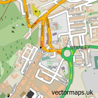
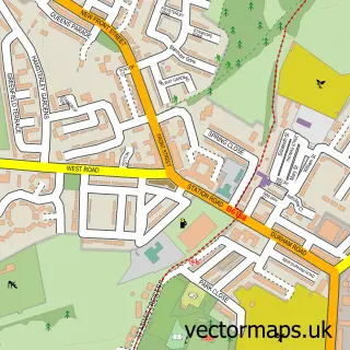
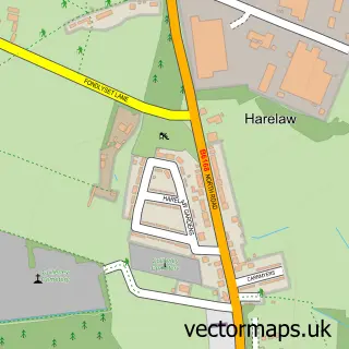
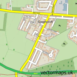
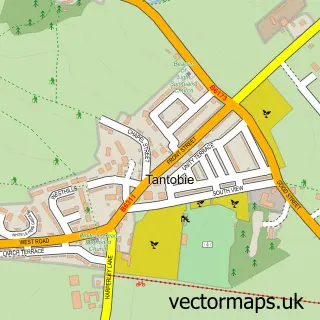
This Catchgate street map is a detailed vector street map covering a 750m x 750m area. Select a larger area to create and download your own vector street map of Catchgate.
The 750-metre map sample for Catchgate covers 421 mapped buildings and approximately 20.9 km of road detail, of which 42 named roads are named. The immediate area includes 1 school, 4 GP surgeries within 2 miles and 2 MOT stations, with 12 within 2 miles. The wider area around Catchgate features 1 food and drink venue. To create a larger or custom map of Catchgate, the map builder lets you define your own coverage area and download editable SVG, PDF and PNG files.
Create a larger editable map of Catchgate
Choose any area you need and generate a high-quality vector map instantly. Perfect for print, planning, design, business and personal use.

This Catchgate street map in Durham is available as downloadable SVG, PDF and PNG map files, or as a printed map for planning, business, display, education, local information and design work. You can also create a larger custom map area using the map selector.
What this Catchgate map sample shows
Catchgate lies within Stanley Cp parish, part of Annfield Plain ward in the County Durham local authority area. The postcode geography for this area includes the DH postcode area, the DH9 postcode district and the DH9 7 postcode sector. Residents fall under the Nhs North East And North Cumbria Integrated Care Board for NHS services.
Local features near Catchgate
Within 2 milesAmenities and services in and around Catchgate.
Administrative and postcode information for Catchgate
The local authority covering Catchgate is County Durham, within the county of Durham. The settlement lies within Annfield Plain ward and Stanley Cp civil parish. The DH9 postcode district and DH9 7 postcode sector serve the immediate area. NHS provision in the area is delivered through County Durham And Darlington Nhs Foundation Trust.
Nearby street map samples around Catchgate

More street maps in Durham
750 metre map area coverage
Boundary, postcode and point of interest information for the 750m x 750m rectangle centred on this sample map.
Boundaries containing map centre
Constituency: North Durham Co Const
District: County Durham
Icb: NHS North East and North Cumbria ICB
Parish: Stanley CP
Police Force: durham
Postcode District: DH9
Postcode Sector: DH9 8
Nearby boundaries intersecting sample
No additional intersecting boundaries found.
Postcode coverage
POI category counts
Convenience Store: 4
Contractor: 2
Fish And Chips Restaurant: 2
Funeral Services And Cemeteries: 2
Retail: 2
Shipping Center: 2
Active Life: 1
Atms: 1
Automotive Repair: 1
Barber: 1
Sample points of interest
- Julies Swim School
- Bestone
- North Road Garage
- A&M Turkish Barbers
- Nails by Sian
- The Mop Shop
- North Road Gym Amateur Boxing Club
- Papaver Designs
- 5 Star Carpet Cleaning
- Golden Dragon-Catchgate
- Morrison Maintenance & Repairs
- G & C Motors
Create a larger editable map of Catchgate
This sample shows only a 750 metre area. To create a larger map of Catchgate, use our map builder to choose your own coverage area, add titles and download editable SVG, PDF and PNG files.
Create a custom map of Catchgate