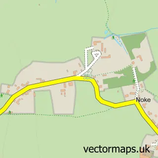
This Charlton-on-Otmoor street map is a detailed vector street map covering a 750m x 750m area. Select a larger area to create and download your own vector street map of Charlton-on-Otmoor.
The 750-metre map sample for Charlton-on-Otmoor covers 172 mapped buildings and approximately 24.8 km of road detail, of which 13 named roads are named. The immediate area includes 1 school and 1 pub. The wider area around Charlton-on-Otmoor features 1 food and drink venue. To create a larger or custom map of Charlton-on-Otmoor, the map builder lets you define your own coverage area and download editable SVG, PDF and PNG files.
Create a larger editable map of Charlton-on-Otmoor
Choose any area you need and generate a high-quality vector map instantly. Perfect for print, planning, design, business and personal use.

This Charlton-on-Otmoor street map in Oxfordshire is available as downloadable SVG, PDF and PNG map files, or as a printed map for planning, business, display, education, local information and design work. You can also create a larger custom map area using the map selector.
What this Charlton-on-Otmoor map sample shows
Charlton-on-Otmoor lies within Charlton-On-Otmoor Cp parish, part of Launton And Otmoor ward in the Cherwell District local authority area. The postcode geography for this area includes the OX postcode area, the OX5 postcode district and the OX5 2 postcode sector. Residents fall under the Nhs Buckinghamshire, Oxfordshire And Berkshire West Integrated Care Board for NHS services.
Local features near Charlton-on-Otmoor
Within 2 milesAmenities and services in and around Charlton-on-Otmoor.
Administrative and postcode information for Charlton-on-Otmoor
The local authority covering Charlton-on-Otmoor is Cherwell District, within the county of Oxfordshire. The settlement lies within Launton And Otmoor ward and Charlton-On-Otmoor Cp civil parish. The OX5 postcode district and OX5 2 postcode sector serve the immediate area. NHS provision in the area is delivered through Oxford University Hospitals Nhs Foundation Trust.
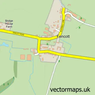
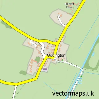
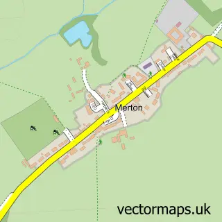
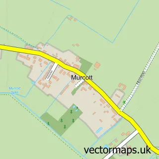
Nearby street map samples around Charlton-on-Otmoor


More street maps in Oxfordshire
750 metre map area coverage
Boundary, postcode and point of interest information for the 750m x 750m rectangle centred on this sample map.
Boundaries containing map centre
Constituency: Bicester and Woodstock Co Const
County: Oxfordshire County
District: Cherwell District
Icb: NHS Thames Valley ICB
Parish: Charlton-on-Otmoor CP
Police Force: thames valley
Postcode District: OX5
Postcode Sector: OX5 2
Ward: Launton & Otmoor Ward
Nearby boundaries intersecting sample
Parish: Fencott and Murcott CP
Postcode coverage
POI category counts
Anglican Church: 1
Electrician: 1
Elementary School: 1
Engineering Services: 1
Musical Instrument Store: 1
Paint Store: 1
Pilates Studio: 1
Pub: 1
Retail: 1
Transportation: 1
Sample points of interest
- St Mary the Virgin, Charlton-on-Otmoor
- H & R Services Oxford
- Charlton on Otmoor Primary School
- Meccanica Engineering
- Brian Carlick
- Dulux Decorator Centre
- Chiltern Bodymatters Ltd.
- The Crown
- Heather Power
- Charlton Services
Create a larger editable map of Charlton-on-Otmoor
This sample shows only a 750 metre area. To create a larger map of Charlton-on-Otmoor, use our map builder to choose your own coverage area, add titles and download editable SVG, PDF and PNG files.
Create a custom map of Charlton-on-Otmoor