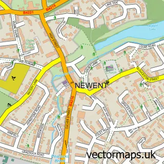
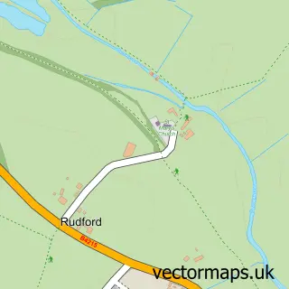
This Churcham street map is a detailed vector street map covering a 750m x 750m area. Select a larger area to create and download your own vector street map of Churcham.
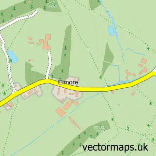
The 750-metre map sample for Churcham covers 38 mapped buildings and approximately 11.7 km of road detail, of which 1 named road are named. The immediate area includes 1 GP surgery within 2 miles. The wider area around Churcham features 1 tourism point of interest. To create a larger or custom map of Churcham, the map builder lets you define your own coverage area and download editable SVG, PDF and PNG files.
Create a larger editable map of Churcham
Choose any area you need and generate a high-quality vector map instantly. Perfect for print, planning, design, business and personal use.

This Churcham street map in Gloucestershire is available as downloadable SVG, PDF and PNG map files, or as a printed map for planning, business, display, education, local information and design work. You can also create a larger custom map area using the map selector.
What this Churcham map sample shows
Churcham lies within Churcham Cp parish, part of Longhope & Huntley ward in the Forest Of Dean District local authority area. The postcode geography for this area includes the GL postcode area, the GL2 postcode district and the GL2 8 postcode sector. Residents fall under the Nhs Gloucestershire Integrated Care Board for NHS services.
Local features near Churcham
Within 2 milesAmenities and services in and around Churcham.
Administrative and postcode information for Churcham
The local authority covering Churcham is Forest Of Dean District, within the county of Gloucestershire. The settlement lies within Longhope & Huntley ward and Churcham Cp civil parish. The GL2 postcode district and GL2 8 postcode sector serve the immediate area. NHS provision in the area is delivered through Gloucestershire Hospitals Nhs Foundation Trust.
Nearby street map samples around Churcham

More street maps in Gloucestershire
750 metre map area coverage
Boundary, postcode and point of interest information for the 750m x 750m rectangle centred on this sample map.
Boundaries containing map centre
Constituency: Forest of Dean Co Const
County: Gloucestershire County
District: Forest of Dean District
Icb: NHS Gloucestershire ICB
Parish: Churcham CP
Police Force: gloucestershire
Postcode District: GL2
Postcode Sector: GL2 8
Ward: Longhope & Huntley Ward
Nearby boundaries intersecting sample
No additional intersecting boundaries found.
Postcode coverage
POI category counts
Carpenter: 1
Caterer: 1
Commercial Industrial: 1
Flight School: 1
Food: 1
Gun And Ammo: 1
Park: 1
Printing Equipment And Supply: 1
Retail: 1
Telecommunications: 1
Sample points of interest
- S P L Carpentry
- Gloucester Event Hire
- Hanshel Seals & Mouldings
- Velocity Flight Training
- Tubby Tom's
- Countryman Sports (www.countrymansports.co.uk)
- Churcham Business Park
- Inky Little Fingers
- Acoustic Polymers
- Wireless Innovation Ltd.
Create a larger editable map of Churcham
This sample shows only a 750 metre area. To create a larger map of Churcham, use our map builder to choose your own coverage area, add titles and download editable SVG, PDF and PNG files.
Create a custom map of Churcham