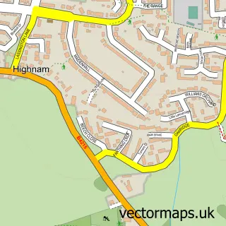
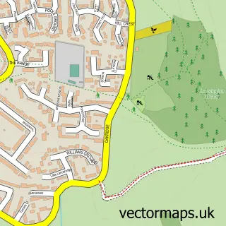
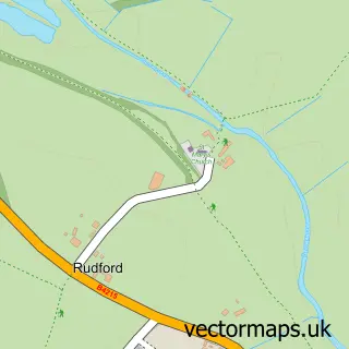
This Minsterworth street map is a detailed vector street map covering a 750m x 750m area. Select a larger area to create and download your own vector street map of Minsterworth.
The 750-metre map sample for Minsterworth covers 100 mapped buildings and approximately 21.7 km of road detail, of which 4 named roads are named. The wider area around Minsterworth features 1 tourism point of interest. To create a larger or custom map of Minsterworth, the map builder lets you define your own coverage area and download editable SVG, PDF and PNG files.
Create a larger editable map of Minsterworth
Choose any area you need and generate a high-quality vector map instantly. Perfect for print, planning, design, business and personal use.

This Minsterworth street map in Gloucestershire is available as downloadable SVG, PDF and PNG map files, or as a printed map for planning, business, display, education, local information and design work. You can also create a larger custom map area using the map selector.
What this Minsterworth map sample shows
Minsterworth lies within Minsterworth Cp parish, part of Highnam With Haw Bridge ward in the Tewkesbury District (B) local authority area. The postcode geography for this area includes the GL postcode area, the GL2 postcode district and the GL2 8 postcode sector. Residents fall under the Nhs Gloucestershire Integrated Care Board for NHS services.
Local features near Minsterworth
Within 2 milesAmenities and services in and around Minsterworth.
Administrative and postcode information for Minsterworth
Minsterworth lies within Minsterworth Cp parish, part of Highnam With Haw Bridge ward in the Tewkesbury District (B) local authority area. The postcode geography for this area includes the GL postcode area, the GL2 postcode district and the GL2 8 postcode sector. Residents fall under the Nhs Gloucestershire Integrated Care Board for NHS services.
Nearby street map samples around Minsterworth

More street maps in Gloucestershire
750 metre map area coverage
Boundary, postcode and point of interest information for the 750m x 750m rectangle centred on this sample map.
Boundaries containing map centre
Constituency: Forest of Dean Co Const
County: Gloucestershire County
District: Tewkesbury District (B)
Icb: NHS Gloucestershire ICB
Parish: Minsterworth CP
Police Force: gloucestershire
Postcode District: GL2
Postcode Sector: GL2 8
Ward: Highnam with Haw Bridge Ward
Nearby boundaries intersecting sample
Constituency: North Cotswolds Co Const
District: Forest of Dean District, Stroud District
Parish: Churcham CP, Elmore CP
Postcode Sector: GL2 3
Ward: Hardwicke Ward, Longhope & Huntley Ward
Postcode coverage
POI category counts
Church Cathedral: 2
Elementary School: 2
Anglican Church: 1
Assisted Living Facility: 1
Bed And Breakfast: 1
Community Center: 1
Flowers And Gifts Shop: 1
Landmark And Historical Building: 1
Pest Control Service: 1
Sample points of interest
- St Peter's
- Orchard End
- The Naight House B&B
- Minsterworth Church Severn Bore Viewing Point
- St. Peter's Church
- Minsterworth Village Hall
- Minsterworth Church of England Primary School
- Walmore Hill Primary School
- Flowerama Designs
- Minsterworth
- 101 Environmental
Create a larger editable map of Minsterworth
This sample shows only a 750 metre area. To create a larger map of Minsterworth, use our map builder to choose your own coverage area, add titles and download editable SVG, PDF and PNG files.
Create a custom map of Minsterworth