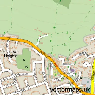
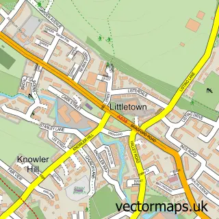
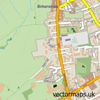
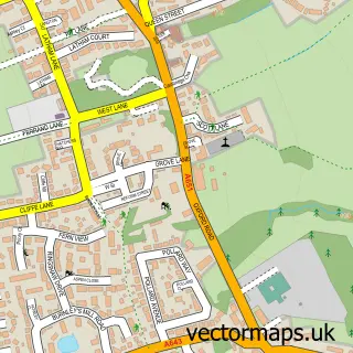
This Cleckheaton street map is a detailed vector street map covering a 750m x 750m area. Select a larger area to create and download your own vector street map of Cleckheaton.
The 750-metre map sample for Cleckheaton covers 393 mapped buildings and approximately 22.1 km of road detail, of which 73 named roads are named. The immediate area includes 1 school, 1 GP surgery, with 8 within 2 miles, 9 pubs and 1 MOT station, with 14 within 2 miles. The wider area around Cleckheaton features 4 tourism points of interest, 22 food and drink venues and 1 hotel. To create a larger or custom map of Cleckheaton, the map builder lets you define your own coverage area and download editable SVG, PDF and PNG files.
Create a larger editable map of Cleckheaton
Choose any area you need and generate a high-quality vector map instantly. Perfect for print, planning, design, business and personal use.

This Cleckheaton street map in West Yorkshire is available as downloadable SVG, PDF and PNG map files, or as a printed map for planning, business, display, education, local information and design work. You can also create a larger custom map area using the map selector.
What this Cleckheaton map sample shows
Cleckheaton lies within Kirklees District (B) parish, part of Cleckheaton ward in the Kirklees District (B) local authority area. The postcode geography for this area includes the BD postcode area, the BD19 postcode district and the BD19 5 postcode sector. Residents fall under the Nhs West Yorkshire Integrated Care Board for NHS services.
Local features near Cleckheaton
Within 2 milesAmenities and services in and around Cleckheaton.
Administrative and postcode information for Cleckheaton
Cleckheaton lies within Kirklees District (B) parish, part of Cleckheaton ward in the Kirklees District (B) local authority area. The postcode geography for this area includes the BD postcode area, the BD19 postcode district and the BD19 5 postcode sector. Residents fall under the Nhs West Yorkshire Integrated Care Board for NHS services.
Nearby street map samples around Cleckheaton

More street maps in West Yorkshire
750 metre map area coverage
Boundary, postcode and point of interest information for the 750m x 750m rectangle centred on this sample map.
Boundaries containing map centre
Constituency: Spen Valley Boro Const
District: Kirklees District (B)
Icb: NHS West Yorkshire ICB
Police Force: west yorkshire
Postcode District: BD19
Postcode Sector: BD19 3
Ward: Cleckheaton Ward
Nearby boundaries intersecting sample
Postcode Sector: BD19 4, BD19 5
Postcode coverage
POI category counts
Beauty Salon: 18
Hair Salon: 12
Flowers And Gifts Shop: 10
Pub: 9
Professional Services: 8
Automotive Repair: 7
Cafe: 7
Automotive Parts And Accessories: 6
Bank Credit Union: 6
Real Estate Agent: 6
Sample points of interest
- Peter G Jackson & Co.
- TaxAssist Accountants
- TaxAssist Accountants
- Yorkshire Accountant & Taxation Consultant Ltd.
- Clarity Acupuncture Clinic
- Rachael Thompson Acupuncture
- Bms Marketing Services
- JES Displays
- Lloyd Simpson Incentives
- Slimming World
- RSPCA
- Kirkwood Hospice Shop
Create a larger editable map of Cleckheaton
This sample shows only a 750 metre area. To create a larger map of Cleckheaton, use our map builder to choose your own coverage area, add titles and download editable SVG, PDF and PNG files.
Create a custom map of Cleckheaton