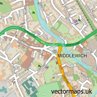
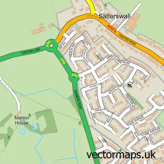
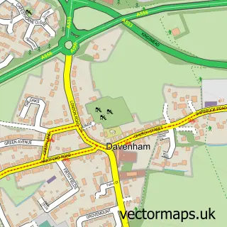
This Clive street map is a detailed vector street map covering a 750m x 750m area. Select a larger area to create and download your own vector street map of Clive.
The 750-metre map sample for Clive covers 128 mapped buildings and approximately 6.5 km of road detail, of which 6 named roads are named. The immediate area includes 6 GP surgeries within 2 miles and 16 MOT stations within 2 miles. To create a larger or custom map of Clive, the map builder lets you define your own coverage area and download editable SVG, PDF and PNG files.
Create a larger editable map of Clive
Choose any area you need and generate a high-quality vector map instantly. Perfect for print, planning, design, business and personal use.

This Clive street map in Cheshire is available as downloadable SVG, PDF and PNG map files, or as a printed map for planning, business, display, education, local information and design work. You can also create a larger custom map area using the map selector.
What this Clive map sample shows
Clive lies within Winsford Cp parish, part of Winsford Wharton ward in the Cheshire West And Chester (B) local authority area. The postcode geography for this area includes the CW postcode area, the CW7 postcode district and the CW7 3 postcode sector. Residents fall under the Nhs Cheshire And Merseyside Integrated Care Board for NHS services.
Local features near Clive
Within 2 milesAmenities and services in and around Clive.
Administrative and postcode information for Clive
The local authority covering Clive is Cheshire West And Chester (B), within the county of Cheshire. The settlement lies within Winsford Wharton ward and Winsford Cp civil parish. The CW7 postcode district and CW7 3 postcode sector serve the immediate area. NHS provision in the area is delivered through Mid Cheshire Hospitals Nhs Foundation Trust.
Nearby street map samples around Clive

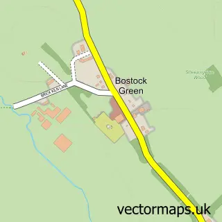
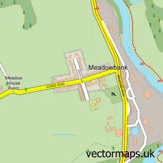
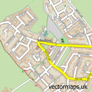
More street maps in Cheshire
750 metre map area coverage
Boundary, postcode and point of interest information for the 750m x 750m rectangle centred on this sample map.
Boundaries containing map centre
Constituency: Mid Cheshire Co Const
District: Cheshire West and Chester (B)
Icb: NHS Cheshire and Merseyside ICB
Parish: Winsford CP
Police Force: cheshire
Postcode District: CW7
Postcode Sector: CW7 3
Ward: Winsford Gravel Ward
Nearby boundaries intersecting sample
Parish: Stanthorne and Wimboldsley CP
Postcode District: CW10
Postcode Sector: CW10 9
Postcode coverage
POI category counts
Automotive Repair: 6
Furniture Store: 4
Professional Services: 4
Engineering Services: 2
Industrial Equipment: 2
Powder Coating Service: 2
Arts And Crafts: 1
Auction House: 1
Auto Body Shop: 1
Car Dealer: 1
Sample points of interest
- Daydream Dolls
- SYNETIQ Winsford
- KC Autos
- K C Autos
- KC Autos Accident Repair Centres Ltd
- Smooth Dent Removal
- Velocity Motor Solutions
- Velocity Motor Solutions
- Winsford Body Shop
- Agkcarsandson
- Shazzibb's Country Champagne Bar
- Ash Workwear
Create a larger editable map of Clive
This sample shows only a 750 metre area. To create a larger map of Clive, use our map builder to choose your own coverage area, add titles and download editable SVG, PDF and PNG files.
Create a custom map of Clive