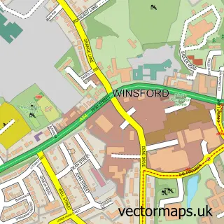
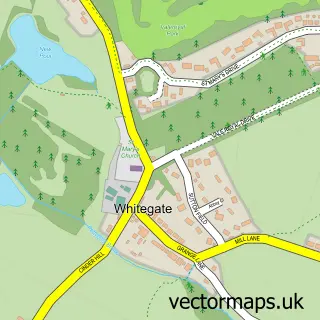
This Moulton street map is a detailed vector street map covering a 750m x 750m area. Select a larger area to create and download your own vector street map of Moulton.
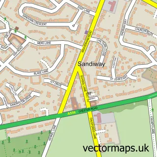
The 750-metre map sample for Moulton covers 539 mapped buildings and approximately 16.1 km of road detail, of which 31 named roads are named. The immediate area includes 1 school, 1 GP surgery within 2 miles, 3 pubs and 4 MOT stations within 2 miles. The wider area around Moulton features 2 tourism points of interest and 4 food and drink venues. To create a larger or custom map of Moulton, the map builder lets you define your own coverage area and download editable SVG, PDF and PNG files.
Create a larger editable map of Moulton
Choose any area you need and generate a high-quality vector map instantly. Perfect for print, planning, design, business and personal use.

This Moulton street map in Cheshire is available as downloadable SVG, PDF and PNG map files, or as a printed map for planning, business, display, education, local information and design work. You can also create a larger custom map area using the map selector.
What this Moulton map sample shows
Moulton lies within Moulton Cp parish, part of Davenham, Moulton & Kingsmead ward in the Cheshire West And Chester (B) local authority area. The postcode geography for this area includes the CW postcode area, the CW9 postcode district and the CW9 8 postcode sector. Residents fall under the Nhs Cheshire And Merseyside Integrated Care Board for NHS services.
Local features near Moulton
Within 2 milesAmenities and services in and around Moulton.
Administrative and postcode information for Moulton
The local authority covering Moulton is Cheshire West And Chester (B), within the county of Cheshire. The settlement lies within Davenham, Moulton & Kingsmead ward and Moulton Cp civil parish. The CW9 postcode district and CW9 8 postcode sector serve the immediate area. NHS provision in the area is delivered through Mid Cheshire Hospitals Nhs Foundation Trust.
Nearby street map samples around Moulton

More street maps in Cheshire
750 metre map area coverage
Boundary, postcode and point of interest information for the 750m x 750m rectangle centred on this sample map.
Boundaries containing map centre
Constituency: Mid Cheshire Co Const
District: Cheshire West and Chester (B)
Icb: NHS Cheshire and Merseyside ICB
Parish: Moulton CP
Police Force: cheshire
Postcode District: CW9
Postcode Sector: CW9 8
Ward: Davenham, Moulton & Kingsmead Ward
Nearby boundaries intersecting sample
Parish: Davenham CP
Postcode coverage
POI category counts
Bar: 4
Pub: 3
Elementary School: 2
Park: 2
Pet Groomer: 2
Shipping Center: 2
Advertising Agency: 1
Atms: 1
Automotive: 1
Broadcasting Media Production: 1
Sample points of interest
- Cheshire Cat Marketing
- Morrisons Daily - Whitlow Lane, Moulton
- Cartech
- Bar Five in Moulton
- Burns Sports Bar Moulton
- Moulton Royal British Legion Social Club
- The Olive Tree
- Northwich Repeater Group
- Find And be Found
- The Crows Nest Cafe
- Flourish Pantry
- Dynasty
Create a larger editable map of Moulton
This sample shows only a 750 metre area. To create a larger map of Moulton, use our map builder to choose your own coverage area, add titles and download editable SVG, PDF and PNG files.
Create a custom map of Moulton