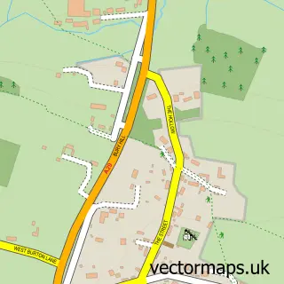
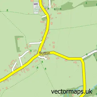
This Coldwaltham street map is a detailed vector street map covering a 750m x 750m area. Select a larger area to create and download your own vector street map of Coldwaltham.
The 750-metre map sample for Coldwaltham covers 220 mapped buildings and approximately 9.9 km of road detail, of which 12 named roads are named. The immediate area includes 1 school, 1 pub and 2 MOT stations within 2 miles. The wider area around Coldwaltham features 1 food and drink venue. To create a larger or custom map of Coldwaltham, the map builder lets you define your own coverage area and download editable SVG, PDF and PNG files.
Create a larger editable map of Coldwaltham
Choose any area you need and generate a high-quality vector map instantly. Perfect for print, planning, design, business and personal use.

This Coldwaltham street map in West Sussex is available as downloadable SVG, PDF and PNG map files, or as a printed map for planning, business, display, education, local information and design work. You can also create a larger custom map area using the map selector.
What this Coldwaltham map sample shows
Coldwaltham lies within Coldwaltham Cp parish, part of Pulborough, Coldwaltham & Amberley ward in the Horsham District local authority area. The postcode geography for this area includes the RH postcode area, the RH20 postcode district and the RH20 1 postcode sector. Residents fall under the Nhs Sussex Integrated Care Board for NHS services.
Local features near Coldwaltham
Within 2 milesAmenities and services in and around Coldwaltham.
Administrative and postcode information for Coldwaltham
Coldwaltham lies within Coldwaltham Cp parish, part of Pulborough, Coldwaltham & Amberley ward in the Horsham District local authority area. The postcode geography for this area includes the RH postcode area, the RH20 postcode district and the RH20 1 postcode sector. Residents fall under the Nhs Sussex Integrated Care Board for NHS services.
Nearby street map samples around Coldwaltham

More street maps in West Sussex
750 metre map area coverage
Boundary, postcode and point of interest information for the 750m x 750m rectangle centred on this sample map.
Boundaries containing map centre
Constituency: Arundel and South Downs Co Const
County: West Sussex County
District: Horsham District
Icb: NHS Surrey and Sussex ICB
Parish: Coldwaltham CP
Police Force: sussex
Postcode District: RH20
Postcode Sector: RH20 1
Ward: Pulborough, Coldwaltham & Amberley Ward
Nearby boundaries intersecting sample
Parish: Parham CP
Postcode coverage
POI category counts
Shipping Center: 2
Anglican Church: 1
Antique Store: 1
Elementary School: 1
It Service And Computer Repair: 1
Key And Locksmith: 1
Language School: 1
Machine And Tool Rentals: 1
Nature Reserve: 1
Plumbing: 1
Sample points of interest
- St Giles
- The Vintage Garden Company Sussex
- St James Church of England Primary School
- Commonsense Computing
- A & J Locksmiths
- La Jolie Ronde Languages for Children
- Hire Intelligence
- Waltham Brooks Nature Reserve
- DPS Plumbing & Heating Services
- Chuckleberries Pre-School
- Logic Complex
- The Labouring Man
Create a larger editable map of Coldwaltham
This sample shows only a 750 metre area. To create a larger map of Coldwaltham, use our map builder to choose your own coverage area, add titles and download editable SVG, PDF and PNG files.
Create a custom map of Coldwaltham