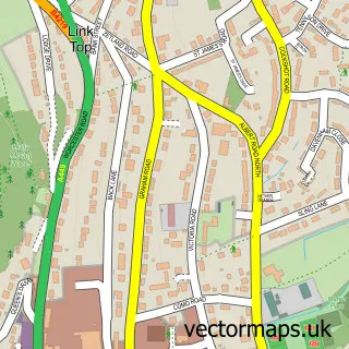
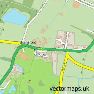
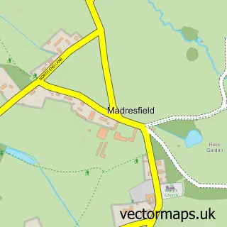
This Colletts Green street map is a detailed vector street map covering a 750m x 750m area. Select a larger area to create and download your own vector street map of Colletts Green.
The 750-metre map sample for Colletts Green covers 281 mapped buildings and approximately 44.7 km of road detail, of which 19 named roads are named. The immediate area includes 1 GP surgery within 2 miles, 3 pubs and 1 MOT station, with 5 within 2 miles. The wider area around Colletts Green features 3 food and drink venues. To create a larger or custom map of Colletts Green, the map builder lets you define your own coverage area and download editable SVG, PDF and PNG files.
Create a larger editable map of Colletts Green
Choose any area you need and generate a high-quality vector map instantly. Perfect for print, planning, design, business and personal use.

This Colletts Green street map in Worcestershire is available as downloadable SVG, PDF and PNG map files, or as a printed map for planning, business, display, education, local information and design work. You can also create a larger custom map area using the map selector.
What this Colletts Green map sample shows
Colletts Green lies within Powick Cp parish, part of Powick ward in the Malvern Hills District local authority area. The postcode geography for this area includes the WR postcode area, the WR2 postcode district and the WR2 4 postcode sector. Residents fall under the Nhs Herefordshire And Worcestershire Integrated Care Board for NHS services.
Local features near Colletts Green
Within 2 milesAmenities and services in and around Colletts Green.
Administrative and postcode information for Colletts Green
The local authority covering Colletts Green is Malvern Hills District, within the county of Worcestershire. The settlement lies within Powick ward and Powick Cp civil parish. The WR2 postcode district and WR2 4 postcode sector serve the immediate area. NHS provision in the area is delivered through Worcestershire Acute Hospitals Nhs Trust.
Nearby street map samples around Colletts Green

More street maps in Worcestershire
750 metre map area coverage
Boundary, postcode and point of interest information for the 750m x 750m rectangle centred on this sample map.
Boundaries containing map centre
Constituency: West Worcestershire Co Const
County: Worcestershire County
District: Malvern Hills District
Icb: NHS Herefordshire and Worcestershire ICB
Parish: Powick CP
Police Force: west mercia
Postcode District: WR2
Postcode Sector: WR2 4
Ward: Powick & the Hanleys Ward
Nearby boundaries intersecting sample
No additional intersecting boundaries found.
Postcode coverage
POI category counts
Pub: 3
Automotive: 2
Architectural Designer: 1
Arts And Crafts: 1
Automotive Dealer: 1
Baby Gear And Furniture: 1
Bar: 1
Beauty Salon: 1
Bridal Shop: 1
Business: 1
Sample points of interest
- Brian Heap Architect
- Foot of the Hills laser and leather craft
- Startin Skoda Powick Worcester
- Startin Smart Repair Centre
- Startin Škoda
- Kids Closet
- Three Nuns
- Ruby Tuesday Nail Bar
- Celebration String Quartet Trios Duos
- ezicare
- World Development Systems
- Bowling Green Garage - Startin
Create a larger editable map of Colletts Green
This sample shows only a 750 metre area. To create a larger map of Colletts Green, use our map builder to choose your own coverage area, add titles and download editable SVG, PDF and PNG files.
Create a custom map of Colletts Green