Vector Maps logo
Home Why it works Popular maps Districts Samples Customizer Create Your Map
VectorMaps.uk
Home Popular maps Districts Samples Customizer Create Your Map Privacy Disclaimer
Home / UK Maps / South Yorkshire / Conisbrough Map

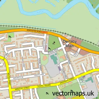
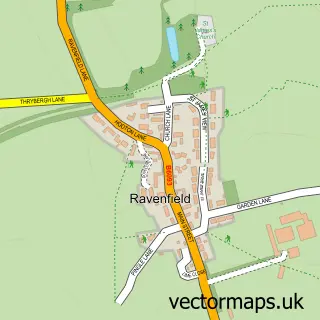
This Conisbrough street map is a detailed vector street map covering a 750m x 750m area. Select a larger area to create and download your own vector street map of Conisbrough.

Conisbrough is a town in South Yorkshire, in the Yorkshire And The Humber of England. Historically, the area formed part of Yorkshire. The settlement falls within the Don Valley parliamentary constituency. It is served by the DN12 postcode district, with

The 750-metre map sample for Conisbrough covers 534 mapped buildings and approximately 31.1 km of road detail, of which 50 named roads are named. The immediate area includes 2 GP surgeries, with 5 within 2 miles, 5 pubs and 10 MOT stations within 2 miles. The wider area around Conisbrough features 1 tourism point of interest, 8 food and drink venues and 1 hotel. To create a larger or custom map of Conisbrough, the map builder lets you define your own coverage area and download editable SVG, PDF and PNG files.

534Buildings
31.11 kmRoads
50Named roads
11,880Residents within 2 miles
Create your own

Create a larger editable map of Conisbrough

Choose any area you need and generate a high-quality vector map instantly. Perfect for print, planning, design, business and personal use.

Choose any location
Editable SVG files
Any size up to A0
PDF, PNG & more
Instant download
High quality guaranteed
Create My Custom Map
Secure, private & no credit card required
Conisbrough Vector Street Map
750m Sample
Conisbrough vector street map sample showing roads, buildings and local features in a 750 metre preview area
Buy Conisbrough Map Print from £12.95 Buy Conisbrough Digital Map from £6

This Conisbrough street map in South Yorkshire is available as downloadable SVG, PDF and PNG map files, or as a printed map for planning, business, display, education, local information and design work. You can also create a larger custom map area using the map selector.

What this Conisbrough map sample shows

Conisbrough lies within Doncaster District (B) parish, part of Conisbrough ward in the Doncaster District (B) local authority area. The postcode geography for this area includes the DN postcode area, the DN12 postcode district and the DN12 2 postcode sector. Residents fall under the Nhs South Yorkshire Integrated Care Board for NHS services.

Local features near Conisbrough

Within 2 miles

Amenities and services in and around Conisbrough.

2 GP surgeries 5 within 2 miles
10 MOT stations within 2 miles
1 Tourism & leisure
8 Food & drink
5 Pubs
1 Hotels
5 Healthcare POIs

Counts are approximate and based on publicly available data.

Administrative and postcode information for Conisbrough

Conisbrough lies within Doncaster District (B) parish, part of Conisbrough ward in the Doncaster District (B) local authority area. The postcode geography for this area includes the DN postcode area, the DN12 postcode district and the DN12 2 postcode sector. Residents fall under the Nhs South Yorkshire Integrated Care Board for NHS services.

Parish DONCASTER DISTRICT (B)
Ward Conisbrough
District / local authority Doncaster District (B)
County South Yorkshire
Historic county Yorkshire
Postcode district DN12
Postcode sector DN12 2
Parliamentary constituency Don Valley
Region Yorkshire and the Humber
Country England

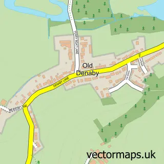
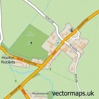
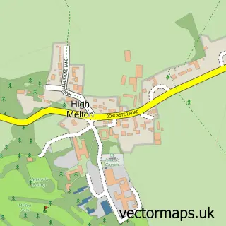
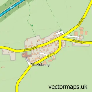
Nearby street map samples around Conisbrough

Street map sample of Doncaster, South Yorkshire Doncaster City - South Yorkshire - 5.0 miles Street map sample of Denaby Main, South Yorkshire Denaby Main Village - South Yorkshire - 1.0 miles Street map sample of Cadeby, South Yorkshire Cadeby Village - South Yorkshire - 1.3 miles Street map sample of Clifton, South Yorkshire Clifton Village - South Yorkshire - 1.5 miles Street map sample of Old Edlington, South Yorkshire Old Edlington Village - South Yorkshire - 1.6 miles Street map sample of Old Denaby, South Yorkshire Old Denaby Village - South Yorkshire - 1.8 miles Street map sample of Hooton Roberts, South Yorkshire Hooton Roberts Village - South Yorkshire - 1.9 miles Street map sample of High Melton, South Yorkshire High Melton Village - South Yorkshire - 2.1 miles Street map sample of Micklebring, South Yorkshire Micklebring Village - South Yorkshire - 2.4 miles Street map sample of Ravenfield, South Yorkshire Ravenfield Village - South Yorkshire - 2.6 miles

More street maps in South Yorkshire

Street map sample of Denaby Main, South Yorkshire Denaby Main Village - 1.0 miles Street map sample of Cadeby, South Yorkshire Cadeby Village - 1.3 miles Street map sample of Clifton, South Yorkshire Clifton Village - 1.5 miles Street map sample of Old Edlington, South Yorkshire Old Edlington Village - 1.6 miles Street map sample of Old Denaby, South Yorkshire Old Denaby Village - 1.8 miles

750 metre map area coverage

Boundary, postcode and point of interest information for the 750m x 750m rectangle centred on this sample map.

Boundaries containing map centre

Constituency: Rawmarsh and Conisbrough Co Const

District: Doncaster District (B)

Icb: NHS South Yorkshire ICB

Police Force: south yorkshire

Postcode District: DN12

Postcode Sector: DN12 2

Ward: Conisbrough Ward

Nearby boundaries intersecting sample

Postcode Sector: DN12 3

Postcode coverage

DN12 DN12 2 DN12 3

POI category counts

Beauty Salon: 9

Hair Salon: 5

Pub: 5

Flowers And Gifts Shop: 4

Bar: 3

Beauty And Spa: 3

Cafe: 3

Chinese Restaurant: 3

Pet Groomer: 3

Pharmacy: 3

Sample points of interest

  • St Peter Conisbrough Anglican Church
  • Conisbrough Arts & Crafts Arts And Crafts
  • The Ivanhoe Centre Arts And Entertainment
  • Xiao Chi Noodle Cafe Asian Fusion Restaurant
  • ATM (Post Office) Atms
  • Conisbrough Atms
  • M X 5 City Auto Parts And Supply Store
  • ADS Motor Spares Automotive Parts And Accessories
  • Cooplands Bakery
  • The Crusty Cob Shop Ltd Bakery
  • NatWest Bank Credit Union
  • Santander Bank Credit Union

Create a larger editable map of Conisbrough

This sample shows only a 750 metre area. To create a larger map of Conisbrough, use our map builder to choose your own coverage area, add titles and download editable SVG, PDF and PNG files.

Create a custom map of Conisbrough

Phone 01751 473136 | Copyright Vectormaps.uk 2026

Samples Customizer Privacy Disclaimer
Conisbrough Vector Street Map
Conisbrough enlarged street map sample showing a 750 metre preview area