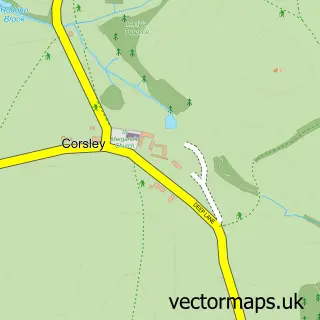
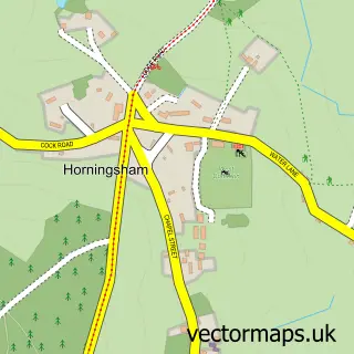
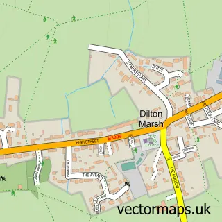
This Corsley Heath street map is a detailed vector street map covering a 750m x 750m area. Select a larger area to create and download your own vector street map of Corsley Heath.
The 750-metre map sample for Corsley Heath covers 123 mapped buildings and approximately 9.6 km of road detail, of which 6 named roads are named. The immediate area includes 1 pub. The wider area around Corsley Heath features 1 tourism point of interest, 1 food and drink venue and 1 campsite within 2 miles. To create a larger or custom map of Corsley Heath, the map builder lets you define your own coverage area and download editable SVG, PDF and PNG files.
Create a larger editable map of Corsley Heath
Choose any area you need and generate a high-quality vector map instantly. Perfect for print, planning, design, business and personal use.

This Corsley Heath street map in Wiltshire is available as downloadable SVG, PDF and PNG map files, or as a printed map for planning, business, display, education, local information and design work. You can also create a larger custom map area using the map selector.
What this Corsley Heath map sample shows
Corsley Heath lies within Corsley Cp parish, part of Warminster Without ward in the Wiltshire local authority area. The postcode geography for this area includes the BA postcode area, the BA12 postcode district and the BA12 7 postcode sector. Residents fall under the Nhs Bath And North East Somerset, Swindon And Wiltshire Integrated Care Board for NHS services.
Local features near Corsley Heath
Within 2 milesAmenities and services in and around Corsley Heath.
Administrative and postcode information for Corsley Heath
Corsley Heath lies within Corsley Cp parish, part of Warminster Without ward in the Wiltshire local authority area. The postcode geography for this area includes the BA postcode area, the BA12 postcode district and the BA12 7 postcode sector. Residents fall under the Nhs Bath And North East Somerset, Swindon And Wiltshire Integrated Care Board for NHS services.
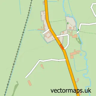
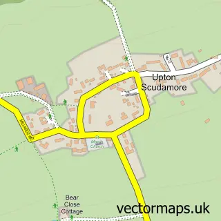
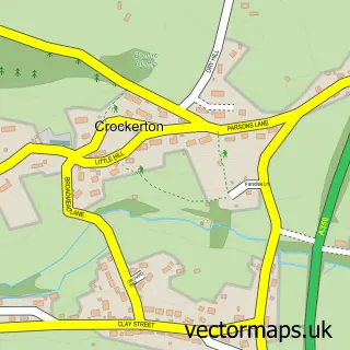
Nearby street map samples around Corsley Heath

More street maps in Wiltshire
750 metre map area coverage
Boundary, postcode and point of interest information for the 750m x 750m rectangle centred on this sample map.
Boundaries containing map centre
Constituency: South West Wiltshire Co Const
District: Wiltshire
Icb: NHS Bath and North East Somerset Swindon and Wiltshire ICB
Parish: Corsley CP
Police Force: wiltshire
Postcode District: BA12
Postcode Sector: BA12 7
Nearby boundaries intersecting sample
No additional intersecting boundaries found.
Postcode coverage
POI category counts
Contractor: 1
Gardener: 1
Gym: 1
It Service And Computer Repair: 1
Mobile Phone Store: 1
Nursery And Gardening: 1
Park: 1
Pet Groomer: 1
Pet Store: 1
Physical Therapy: 1
Sample points of interest
- Advanced Mini Piling Systems
- John White Landscape
- CrossFit Warminster
- TMTI
- Talk Me Through It
- Acres Supply Garden and Aquatics
- Corsley Memorial Playing Field
- Deedles Pets
- Acres Aquatics
- Jessica Church Physiotherapy
- The Royal Oak
- Acres Supply Aquatics
Create a larger editable map of Corsley Heath
This sample shows only a 750 metre area. To create a larger map of Corsley Heath, use our map builder to choose your own coverage area, add titles and download editable SVG, PDF and PNG files.
Create a custom map of Corsley Heath