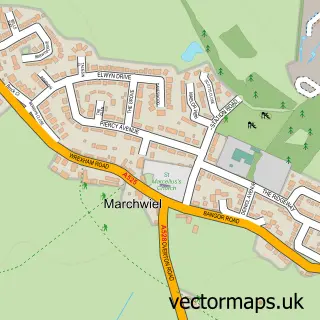
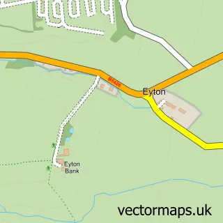
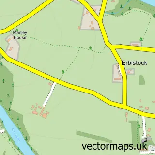
This Cross Lanes street map is a detailed vector street map covering a 750m x 750m area. Select a larger area to create and download your own vector street map of Cross Lanes.
The 750-metre map sample for Cross Lanes covers 158 mapped buildings and approximately 9.6 km of road detail, of which 13 named roads are named. The immediate area includes 1 GP surgery within 2 miles and 8 MOT stations within 2 miles. The wider area around Cross Lanes features 1 tourism point of interest, 1 food and drink venue and 1 campsite within 2 miles. To create a larger or custom map of Cross Lanes, the map builder lets you define your own coverage area and download editable SVG, PDF and PNG files.
Create a larger editable map of Cross Lanes
Choose any area you need and generate a high-quality vector map instantly. Perfect for print, planning, design, business and personal use.

This Cross Lanes street map in Clwyd is available as downloadable SVG, PDF and PNG map files, or as a printed map for planning, business, display, education, local information and design work. You can also create a larger custom map area using the map selector.
What this Cross Lanes map sample shows
Cross Lanes lies within Sesswick Community parish, part of Marchwiel ward in the Wrecsam - Wrexham local authority area. The postcode geography for this area includes the LL postcode area, the LL13 postcode district and the LL13 0 postcode sector. Residents fall under the Betsi Cadwaladr University Health Board for NHS services.
Local features near Cross Lanes
Within 2 milesAmenities and services in and around Cross Lanes.
Administrative and postcode information for Cross Lanes
The local authority covering Cross Lanes is Wrecsam - Wrexham, within the county of Clwyd. The settlement lies within Marchwiel ward and Sesswick Community civil parish. The LL13 postcode district and LL13 0 postcode sector serve the immediate area. NHS provision in the area is delivered through Betsi Cadwaladr University Health Board.
Nearby street map samples around Cross Lanes

More street maps in Clwyd
750 metre map area coverage
Boundary, postcode and point of interest information for the 750m x 750m rectangle centred on this sample map.
Boundaries containing map centre
Constituency: Wrexham Co Const
District: Wrecsam - Wrexham
Icb: Betsi Cadwaladr University
Parish: Sesswick Community
Police Force: north wales
Postcode District: LL13
Postcode Sector: LL13 0
Nearby boundaries intersecting sample
Parish: Marchwiel Community
Postcode coverage
POI category counts
Atms: 1
Bakery: 1
Beauty And Spa: 1
Campground: 1
Coffee Shop: 1
Convenience Store: 1
Fast Food Restaurant: 1
Freight And Cargo Service: 1
Packing Supply: 1
Photography Store And Services: 1
Sample points of interest
- The Cooperative Food (BF) Wrexham, Cross Lanes
- Lowri’s Bake Box
- Bodycare & Beauty
- Gelli Farm Retreat
- Costa Express
- Co-op
- The Pit Stop Wrexham
- AM 2 Pm
- Tetra Pak
- Jaine Briscoe-price Photography
- Co Op @ Wrexham
- Sesswick Halt railway station
Create a larger editable map of Cross Lanes
This sample shows only a 750 metre area. To create a larger map of Cross Lanes, use our map builder to choose your own coverage area, add titles and download editable SVG, PDF and PNG files.
Create a custom map of Cross Lanes