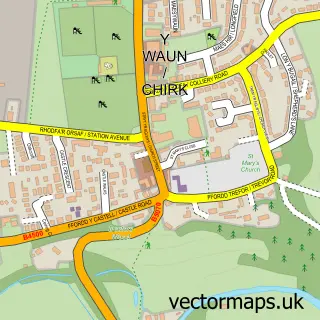
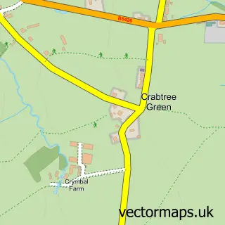
This Marchwiel street map is a detailed vector street map covering a 750m x 750m area. Select a larger area to create and download your own vector street map of Marchwiel.
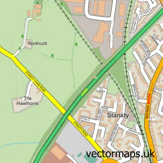
The 750-metre map sample for Marchwiel covers 272 mapped buildings and approximately 12.6 km of road detail, of which 22 named roads are named. The immediate area includes 2 pubs and 1 MOT station, with 8 within 2 miles. The wider area around Marchwiel features 2 food and drink venues and 1 campsite within 2 miles. To create a larger or custom map of Marchwiel, the map builder lets you define your own coverage area and download editable SVG, PDF and PNG files.
Create a larger editable map of Marchwiel
Choose any area you need and generate a high-quality vector map instantly. Perfect for print, planning, design, business and personal use.

This Marchwiel street map in Clwyd is available as downloadable SVG, PDF and PNG map files, or as a printed map for planning, business, display, education, local information and design work. You can also create a larger custom map area using the map selector.
What this Marchwiel map sample shows
Marchwiel lies within Marchwiel Community parish, part of Marchwiel ward in the Wrecsam - Wrexham local authority area. The postcode geography for this area includes the LL postcode area, the LL13 postcode district and the LL13 0 postcode sector. Residents fall under the Betsi Cadwaladr University Health Board for NHS services.
Local features near Marchwiel
Within 2 milesAmenities and services in and around Marchwiel.
Administrative and postcode information for Marchwiel
Marchwiel lies within Marchwiel Community parish, part of Marchwiel ward in the Wrecsam - Wrexham local authority area. The postcode geography for this area includes the LL postcode area, the LL13 postcode district and the LL13 0 postcode sector. Residents fall under the Betsi Cadwaladr University Health Board for NHS services.
Nearby street map samples around Marchwiel

More street maps in Clwyd
750 metre map area coverage
Boundary, postcode and point of interest information for the 750m x 750m rectangle centred on this sample map.
Boundaries containing map centre
Constituency: Wrexham Co Const
District: Wrecsam - Wrexham
Icb: Betsi Cadwaladr University
Parish: Marchwiel Community
Police Force: north wales
Postcode District: LL13
Postcode Sector: LL13 0
Nearby boundaries intersecting sample
No additional intersecting boundaries found.
Postcode coverage
POI category counts
Pub: 2
Automotive Repair: 1
Beauty Salon: 1
Church Cathedral: 1
Cleaning Services: 1
Community Center: 1
Contractor: 1
Courier And Delivery Services: 1
Elementary School: 1
Furniture Store: 1
Sample points of interest
- Price Motor Company
- The Salon for Hair & Beauty
- The Parish Church of St Deiniol and St Marcella
- Merry Maids
- Piercy Hall Marchwiel
- Wrexham County Tar LTD
- Evri ParcelShop
- Ysgol Deiniol County Primary School
- J Scott Furnishers
- Marchwiel Stores
- Red Lion
- Red Lion
Create a larger editable map of Marchwiel
This sample shows only a 750 metre area. To create a larger map of Marchwiel, use our map builder to choose your own coverage area, add titles and download editable SVG, PDF and PNG files.
Create a custom map of Marchwiel