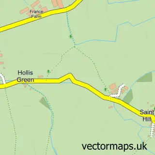
This Culmstock street map is a detailed vector street map covering a 750m x 750m area. Select a larger area to create and download your own vector street map of Culmstock.
The 750-metre map sample for Culmstock covers 121 mapped buildings and approximately 7.8 km of road detail, of which 8 named roads are named. The immediate area includes 1 pub and 1 MOT station. The wider area around Culmstock features 2 food and drink venues. To create a larger or custom map of Culmstock, the map builder lets you define your own coverage area and download editable SVG, PDF and PNG files.
Create a larger editable map of Culmstock
Choose any area you need and generate a high-quality vector map instantly. Perfect for print, planning, design, business and personal use.

This Culmstock street map in Devon is available as downloadable SVG, PDF and PNG map files, or as a printed map for planning, business, display, education, local information and design work. You can also create a larger custom map area using the map selector.
What this Culmstock map sample shows
Culmstock lies within Culmstock Cp parish, part of Upper Culm ward in the Mid Devon District local authority area. The postcode geography for this area includes the EX postcode area, the EX15 postcode district and the EX15 3 postcode sector. Residents fall under the Nhs Devon Integrated Care Board for NHS services.
Local features near Culmstock
Within 2 milesAmenities and services in and around Culmstock.
Administrative and postcode information for Culmstock
Culmstock lies within Culmstock Cp parish, part of Upper Culm ward in the Mid Devon District local authority area. The postcode geography for this area includes the EX postcode area, the EX15 postcode district and the EX15 3 postcode sector. Residents fall under the Nhs Devon Integrated Care Board for NHS services.
Nearby street map samples around Culmstock


More street maps in Devon
750 metre map area coverage
Boundary, postcode and point of interest information for the 750m x 750m rectangle centred on this sample map.
Boundaries containing map centre
Constituency: Tiverton and Minehead Co Const
County: Devon County
District: Mid Devon District
Icb: NHS Devon ICB
Parish: Culmstock CP
Police Force: devon and cornwall
Postcode District: EX15
Postcode Sector: EX15 3
Ward: Upper Culm Ward
Nearby boundaries intersecting sample
No additional intersecting boundaries found.
Postcode coverage
POI category counts
Active Life: 2
Professional Services: 2
Anglican Church: 1
Automotive Repair: 1
Church Cathedral: 1
Delicatessen: 1
Land Surveying: 1
Medical Center: 1
Motorcycle Dealer: 1
Pub: 1
Sample points of interest
- Mypremcoach
- Mypremcoach
- All Saints
- Culmstock Garage
- Culmstock Methodist Church
- The Strand Stores
- Jarman Ward Limited
- Western Counties Equine Hospital
- Squire Motorcycles
- Carlie-Jane Photography
- T P Whitcombe
- Culm Valley Inn
Create a larger editable map of Culmstock
This sample shows only a 750 metre area. To create a larger map of Culmstock, use our map builder to choose your own coverage area, add titles and download editable SVG, PDF and PNG files.
Create a custom map of Culmstock