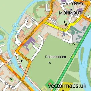
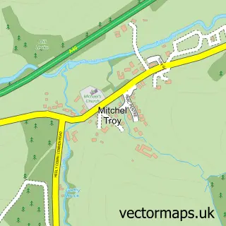
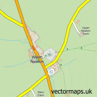
This Dixton street map is a detailed vector street map covering a 750m x 750m area. Select a larger area to create and download your own vector street map of Dixton.
The 750-metre map sample for Dixton covers 33 mapped buildings and approximately 37.0 km of road detail, of which 4 named roads are named. The immediate area includes 1 school and 3 MOT stations within 2 miles. The wider area around Dixton features 2 tourism points of interest and 1 campsite within 2 miles. To create a larger or custom map of Dixton, the map builder lets you define your own coverage area and download editable SVG, PDF and PNG files.
Create a larger editable map of Dixton
Choose any area you need and generate a high-quality vector map instantly. Perfect for print, planning, design, business and personal use.

This Dixton street map in Gwent is available as downloadable SVG, PDF and PNG map files, or as a printed map for planning, business, display, education, local information and design work. You can also create a larger custom map area using the map selector.
What this Dixton map sample shows
Dixton lies within Monmouth Community parish, part of Dixton With Osbaston ward in the Sir Fynwy - Monmouthshire local authority area. The postcode geography for this area includes the NP postcode area, the NP25 postcode district and the NP25 3 postcode sector. Residents fall under the Aneurin Bevan University Health Board for NHS services.
Local features near Dixton
Within 2 milesAmenities and services in and around Dixton.
Administrative and postcode information for Dixton
Dixton lies within Monmouth Community parish, part of Dixton With Osbaston ward in the Sir Fynwy - Monmouthshire local authority area. The postcode geography for this area includes the NP postcode area, the NP25 postcode district and the NP25 3 postcode sector. Residents fall under the Aneurin Bevan University Health Board for NHS services.
Nearby street map samples around Dixton

More street maps in Gwent
750 metre map area coverage
Boundary, postcode and point of interest information for the 750m x 750m rectangle centred on this sample map.
Boundaries containing map centre
Constituency: Monmouthshire Co Const
District: Sir Fynwy - Monmouthshire
Icb: Aneurin Bevan University
Parish: Monmouth Community
Police Force: gwent
Postcode District: NP25
Postcode Sector: NP25 3
Nearby boundaries intersecting sample
No additional intersecting boundaries found.
Postcode coverage
POI category counts
Church Cathedral: 3
Anglican Church: 1
Attractions And Activities: 1
Castle: 1
Lawn Service: 1
Pet Services: 1
School: 1
Spas: 1
Veterinarian: 1
Sample points of interest
- Dixton: St Peter's
- Adventure River
- Dixton Motte
- Dixton Church
- St Peter's & Dixton Monmouth UK Parish News Page
- St Peters Church
- The Green Team
- The Elms Cattery
- Agincourt School
- Peace of Stone
- Elms Veterinary Surgery
Create a larger editable map of Dixton
This sample shows only a 750 metre area. To create a larger map of Dixton, use our map builder to choose your own coverage area, add titles and download editable SVG, PDF and PNG files.
Create a custom map of Dixton