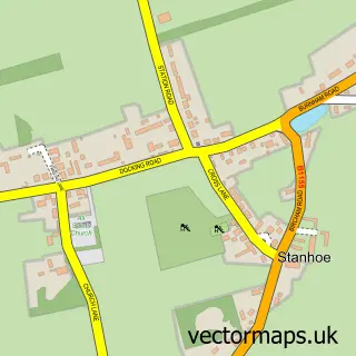
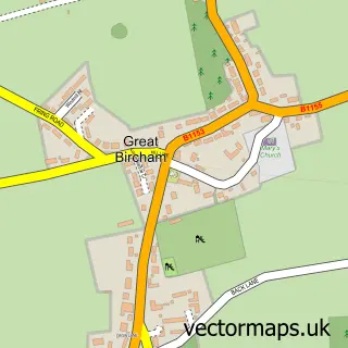
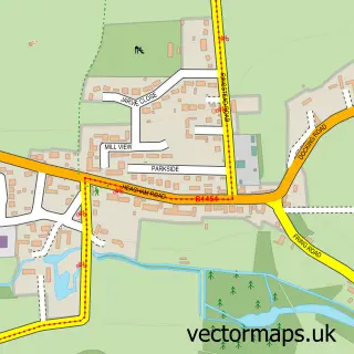
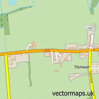
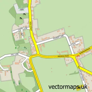
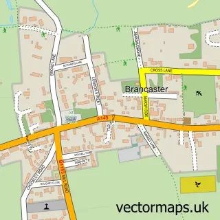
This Docking street map is a detailed vector street map covering a 750m x 750m area. Select a larger area to create and download your own vector street map of Docking.
The 750-metre map sample for Docking covers 200 mapped buildings and approximately 12.4 km of road detail, of which 13 named roads are named. The immediate area includes 1 school. The wider area around Docking features 1 tourism point of interest. To create a larger or custom map of Docking, the map builder lets you define your own coverage area and download editable SVG, PDF and PNG files.
Create a larger editable map of Docking
Choose any area you need and generate a high-quality vector map instantly. Perfect for print, planning, design, business and personal use.

This Docking street map in Norfolk is available as downloadable SVG, PDF and PNG map files, or as a printed map for planning, business, display, education, local information and design work. You can also create a larger custom map area using the map selector.
What this Docking map sample shows
Docking lies within Docking Cp parish, part of Burnham Market & Docking ward in the King's Lynn And West Norfolk District (B) local authority area. The postcode geography for this area includes the PE postcode area, the PE31 postcode district and the PE31 8 postcode sector. Residents fall under the Nhs Norfolk And Waveney Integrated Care Board for NHS services.
Local features near Docking
Within 2 milesAmenities and services in and around Docking.
Administrative and postcode information for Docking
Docking lies within Docking Cp parish, part of Burnham Market & Docking ward in the King's Lynn And West Norfolk District (B) local authority area. The postcode geography for this area includes the PE postcode area, the PE31 postcode district and the PE31 8 postcode sector. Residents fall under the Nhs Norfolk And Waveney Integrated Care Board for NHS services.
Nearby street map samples around Docking

More street maps in Norfolk
750 metre map area coverage
Boundary, postcode and point of interest information for the 750m x 750m rectangle centred on this sample map.
Boundaries containing map centre
Constituency: North West Norfolk Co Const
County: Norfolk County
District: King's Lynn and West Norfolk District (B)
Icb: NHS Norfolk and Waveney ICB
Parish: Docking CP
Police Force: norfolk
Postcode District: PE31
Postcode Sector: PE31 8
Ward: Burnham Market & Docking Ward
Nearby boundaries intersecting sample
No additional intersecting boundaries found.
Postcode coverage
POI category counts
Holiday Rental Home: 2
Korean Grocery Store: 2
Anglican Church: 1
Atms: 1
Bar: 1
Community Center: 1
Community Services Non Profits: 1
Cottage: 1
Doctor: 1
Elementary School: 1
Sample points of interest
- Docking: St Mary
- ATM (Spar Docking)
- Docking Fish Bar
- Docking Village Hall
- Docking Heritage Group
- Sextons Place Norfolk
- Bayfield Surgery
- Docking Primary and Nursery School
- Kenada
- Docking Market
- Holland House Holiday Lets
- The Old School House, Docking, Norfolk
Create a larger editable map of Docking
This sample shows only a 750 metre area. To create a larger map of Docking, use our map builder to choose your own coverage area, add titles and download editable SVG, PDF and PNG files.
Create a custom map of Docking