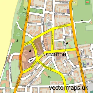
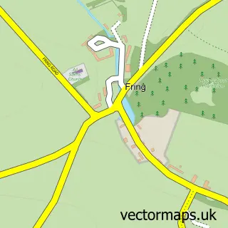
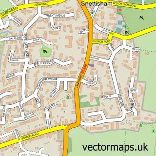
This Ringstead street map is a detailed vector street map covering a 750m x 750m area. Select a larger area to create and download your own vector street map of Ringstead.
The 750-metre map sample for Ringstead covers 151 mapped buildings and approximately 12.1 km of road detail, of which 8 named roads are named. The immediate area includes 1 pub and 1 MOT station within 2 miles. The wider area around Ringstead features 1 tourism point of interest, 1 food and drink venue and 1 hotel. To create a larger or custom map of Ringstead, the map builder lets you define your own coverage area and download editable SVG, PDF and PNG files.
Create a larger editable map of Ringstead
Choose any area you need and generate a high-quality vector map instantly. Perfect for print, planning, design, business and personal use.

This Ringstead street map in Norfolk is available as downloadable SVG, PDF and PNG map files, or as a printed map for planning, business, display, education, local information and design work. You can also create a larger custom map area using the map selector.
What this Ringstead map sample shows
Ringstead lies within Ringstead Cp parish, part of Brancaster ward in the King's Lynn And West Norfolk District (B) local authority area. The postcode geography for this area includes the PE postcode area, the PE36 postcode district and the PE36 5 postcode sector. Residents fall under the Nhs Norfolk And Waveney Integrated Care Board for NHS services.
Local features near Ringstead
Within 2 milesAmenities and services in and around Ringstead.
Administrative and postcode information for Ringstead
The local authority covering Ringstead is King's Lynn And West Norfolk District (B), within the county of Norfolk. The settlement lies within Brancaster ward and Ringstead Cp civil parish. The PE36 postcode district and PE36 5 postcode sector serve the immediate area. NHS provision in the area is delivered through The Queen Elizabeth Hospital, King's Lynn, Nhs Foundation Trust.
Nearby street map samples around Ringstead

More street maps in Norfolk
750 metre map area coverage
Boundary, postcode and point of interest information for the 750m x 750m rectangle centred on this sample map.
Boundaries containing map centre
Constituency: North West Norfolk Co Const
County: Norfolk County
District: King's Lynn and West Norfolk District (B)
Icb: NHS Norfolk and Waveney ICB
Parish: Ringstead CP
Police Force: norfolk
Postcode District: PE36
Postcode Sector: PE36 5
Ward: Brancaster Ward
Nearby boundaries intersecting sample
No additional intersecting boundaries found.
Postcode coverage
POI category counts
Holiday Rental Home: 2
Anglican Church: 1
Art Gallery: 1
Building Supply Store: 1
Convenience Store: 1
Hotel: 1
Museum: 1
Professional Services: 1
Pub: 1
Retail: 1
Sample points of interest
- Ringstead: St Andrew
- The Garage Studio - Art Gallery
- James Everitt Painting & Decorating Home Improvements
- Ringstead Stores
- Manningham House
- Rivendell Holiday Cottage
- Flock Cottage Ringstead
- Greer
- Ringstead Landscapes
- The Gin Trap Inn
- Agricultural Anhydrous Ammonia
- The General Store
Create a larger editable map of Ringstead
This sample shows only a 750 metre area. To create a larger map of Ringstead, use our map builder to choose your own coverage area, add titles and download editable SVG, PDF and PNG files.
Create a custom map of Ringstead