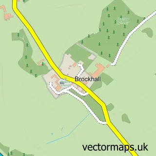
This Dodford street map is a detailed vector street map covering a 750m x 750m area. Select a larger area to create and download your own vector street map of Dodford.
The 750-metre map sample for Dodford covers 67 mapped buildings and approximately 12.3 km of road detail. The immediate area includes 1 GP surgery within 2 miles and 1 MOT station within 2 miles. The wider area around Dodford features 1 hotel. To create a larger or custom map of Dodford, the map builder lets you define your own coverage area and download editable SVG, PDF and PNG files.
Create a larger editable map of Dodford
Choose any area you need and generate a high-quality vector map instantly. Perfect for print, planning, design, business and personal use.

This Dodford street map in Northamptonshire is available as downloadable SVG, PDF and PNG map files, or as a printed map for planning, business, display, education, local information and design work. You can also create a larger custom map area using the map selector.
What this Dodford map sample shows
Dodford lies within Dodford Cp parish, part of Weedon ward in the West Northamptonshire local authority area. The postcode geography for this area includes the NN postcode area, the NN7 postcode district and the NN7 4 postcode sector. Residents fall under the Nhs Northamptonshire Integrated Care Board for NHS services.
Local features near Dodford
Within 2 milesAmenities and services in and around Dodford.
Administrative and postcode information for Dodford
The local authority covering Dodford is West Northamptonshire, within the county of Northamptonshire. The settlement lies within Weedon ward and Dodford Cp civil parish. The NN7 postcode district and NN7 4 postcode sector serve the immediate area. NHS provision in the area is delivered through Northampton General Hospital Nhs Trust.
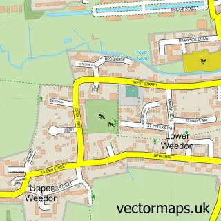
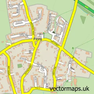
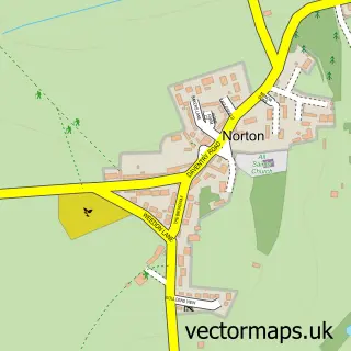
Nearby street map samples around Dodford


More street maps in Northamptonshire
750 metre map area coverage
Boundary, postcode and point of interest information for the 750m x 750m rectangle centred on this sample map.
Boundaries containing map centre
Constituency: Daventry Co Const
District: West Northamptonshire
Icb: NHS Northamptonshire ICB
Parish: Dodford CP
Police Force: northamptonshire
Postcode District: NN7
Postcode Sector: NN7 4
Ward: Woodford & Weedon Ward
Nearby boundaries intersecting sample
No additional intersecting boundaries found.
Postcode coverage
POI category counts
Advertising Agency: 1
Anglican Church: 1
Bed And Breakfast: 1
Business Management Services: 1
Clothing Store: 1
Event Planning: 1
Hotel: 1
Preschool: 1
Venue And Event Space: 1
Sample points of interest
- Sarah Barrett Design
- St Mary the Virgin
- Dodford Grange Bed & Breakfast
- Barrett Sarah Design
- H Mcilroy Boutique
- Dodford Manor
- Magic Mushroom Cabin
- Holbourn House Day Nursery & Pre-School
- Dodford Manor Barn Wedding Venue
Create a larger editable map of Dodford
This sample shows only a 750 metre area. To create a larger map of Dodford, use our map builder to choose your own coverage area, add titles and download editable SVG, PDF and PNG files.
Create a custom map of Dodford