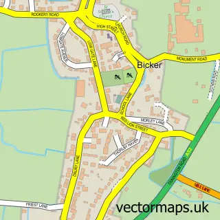
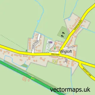
This Donington street map is a detailed vector street map covering a 750m x 750m area. Select a larger area to create and download your own vector street map of Donington.
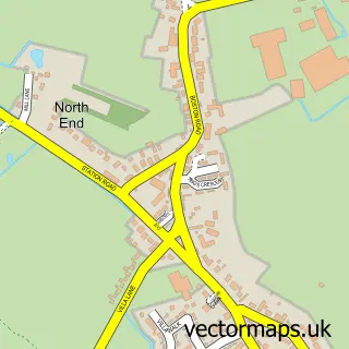
The 750-metre map sample for Donington covers 498 mapped buildings and approximately 16.2 km of road detail, of which 23 named roads are named. The immediate area includes 1 pub and 1 MOT station, with 2 within 2 miles. The wider area around Donington features 1 tourism point of interest and 1 food and drink venue. To create a larger or custom map of Donington, the map builder lets you define your own coverage area and download editable SVG, PDF and PNG files.
Create a larger editable map of Donington
Choose any area you need and generate a high-quality vector map instantly. Perfect for print, planning, design, business and personal use.

This Donington street map in Lincolnshire is available as downloadable SVG, PDF and PNG map files, or as a printed map for planning, business, display, education, local information and design work. You can also create a larger custom map area using the map selector.
What this Donington map sample shows
Donington lies within Donington Cp parish, part of Donington, Quadring And Gosberton ward in the South Holland District local authority area. The postcode geography for this area includes the PE postcode area, the PE11 postcode district and the PE11 4 postcode sector. Residents fall under the Nhs Lincolnshire Integrated Care Board for NHS services.
Local features near Donington
Within 2 milesAmenities and services in and around Donington.
Administrative and postcode information for Donington
Donington lies within Donington Cp parish, part of Donington, Quadring And Gosberton ward in the South Holland District local authority area. The postcode geography for this area includes the PE postcode area, the PE11 postcode district and the PE11 4 postcode sector. Residents fall under the Nhs Lincolnshire Integrated Care Board for NHS services.
Nearby street map samples around Donington

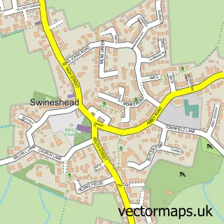
More street maps in Lincolnshire
750 metre map area coverage
Boundary, postcode and point of interest information for the 750m x 750m rectangle centred on this sample map.
Boundaries containing map centre
Constituency: South Holland and The Deepings Co Const
County: Lincolnshire County
District: South Holland District
Icb: NHS Lincolnshire ICB
Parish: Donington CP
Police Force: lincolnshire
Postcode District: PE11
Postcode Sector: PE11 4
Ward: Donington, Quadring and Gosberton Ward
Nearby boundaries intersecting sample
No additional intersecting boundaries found.
Postcode coverage
POI category counts
Community Services Non Profits: 4
Convenience Store: 4
Building Supply Store: 3
Architectural Designer: 2
Automotive Repair: 2
Construction Services: 2
Doctor: 2
Fish And Chips Restaurant: 2
Hair Salon: 2
Package Locker: 2
Sample points of interest
- St Mary & the Holy Rood
- Mews Emporium
- AKM Architecture
- Julian Warrick
- Belle Craft
- SP Suspension Ltd
- J&K Motors
- Station Street Service and MOT Centre
- Lloyds Bank
- Beverley Rose Nails & Beauty
- All that Glitters nail salon
- K D H Projects
Create a larger editable map of Donington
This sample shows only a 750 metre area. To create a larger map of Donington, use our map builder to choose your own coverage area, add titles and download editable SVG, PDF and PNG files.
Create a custom map of Donington