This Dunsop Bridge street map is a detailed vector street map covering a 750m x 750m area. Select a larger area to create and download your own vector street map of Dunsop Bridge.
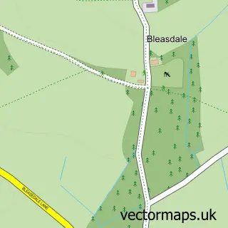
The 750-metre map sample for Dunsop Bridge covers 56 mapped buildings and approximately 14.9 km of road detail. The wider area around Dunsop Bridge features 3 tourism points of interest. To create a larger or custom map of Dunsop Bridge, the map builder lets you define your own coverage area and download editable SVG, PDF and PNG files.
Create a larger editable map of Dunsop Bridge
Choose any area you need and generate a high-quality vector map instantly. Perfect for print, planning, design, business and personal use.

This Dunsop Bridge street map in Lancashire is available as downloadable SVG, PDF and PNG map files, or as a printed map for planning, business, display, education, local information and design work. You can also create a larger custom map area using the map selector.
What this Dunsop Bridge map sample shows
Dunsop Bridge lies within Bowland Forest High Cp parish, part of Chipping ward in the Ribble Valley District (B) local authority area. The postcode geography for this area includes the BB postcode area, the BB7 postcode district and the BB7 3 postcode sector. Residents fall under the Nhs Lancashire And South Cumbria Integrated Care Board for NHS services.
Local features near Dunsop Bridge
Within 2 milesAmenities and services in and around Dunsop Bridge.
Administrative and postcode information for Dunsop Bridge
Dunsop Bridge lies within Bowland Forest High Cp parish, part of Chipping ward in the Ribble Valley District (B) local authority area. The postcode geography for this area includes the BB postcode area, the BB7 postcode district and the BB7 3 postcode sector. Residents fall under the Nhs Lancashire And South Cumbria Integrated Care Board for NHS services.
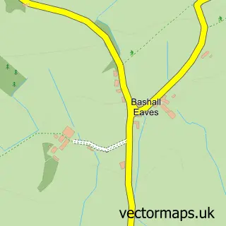
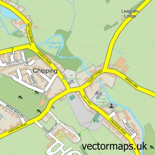
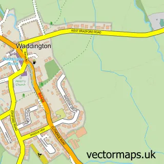
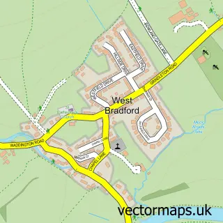
Nearby street map samples around Dunsop Bridge

More street maps in Lancashire
750 metre map area coverage
Boundary, postcode and point of interest information for the 750m x 750m rectangle centred on this sample map.
Boundaries containing map centre
Constituency: Ribble Valley Co Const
County: Lancashire County
District: Ribble Valley District (B)
Icb: NHS Lancashire and South Cumbria ICB
Parish: Bowland Forest High CP
Police Force: lancashire
Postcode District: BB7
Postcode Sector: BB7 3
Ward: Chipping Ward
Nearby boundaries intersecting sample
Parish: Bowland Forest Low CP, Newton CP
Ward: Bowland Ward, Hurst Green & Whitewell Ward
Postcode coverage
POI category counts
Landmark And Historical Building: 2
Bicycle Shop: 1
Business Management Services: 1
Cottage: 1
Event Planning: 1
Fish Farm: 1
Livestock Breeder: 1
Park: 1
Post Office: 1
River: 1
Sample points of interest
- Ribble Valley E-Bikes
- Post Office
- Root Farm House Holiday Cottage
- Wood End Farm
- Dunsop Bridge Trout Farm
- Centre of Great Britain
- Discover Bowland
- Wood End Alpacas
- Dunsop Bridge Playground
- Dunsop Bridge Post Office
- River Dunsop
- Puddleducks Tearooms
Create a larger editable map of Dunsop Bridge
This sample shows only a 750 metre area. To create a larger map of Dunsop Bridge, use our map builder to choose your own coverage area, add titles and download editable SVG, PDF and PNG files.
Create a custom map of Dunsop Bridge