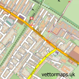
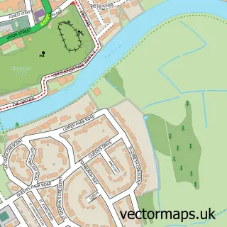
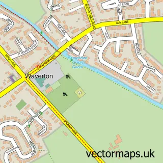
This Eccleston street map is a detailed vector street map covering a 750m x 750m area. Select a larger area to create and download your own vector street map of Eccleston.
The 750-metre map sample for Eccleston covers 75 mapped buildings and approximately 6.2 km of road detail, of which 6 named roads are named. The immediate area includes 1 school and 2 GP surgeries within 2 miles. The wider area around Eccleston features 5 tourism points of interest. To create a larger or custom map of Eccleston, the map builder lets you define your own coverage area and download editable SVG, PDF and PNG files.
Create a larger editable map of Eccleston
Choose any area you need and generate a high-quality vector map instantly. Perfect for print, planning, design, business and personal use.

This Eccleston street map in Cheshire is available as downloadable SVG, PDF and PNG map files, or as a printed map for planning, business, display, education, local information and design work. You can also create a larger custom map area using the map selector.
What this Eccleston map sample shows
Eccleston lies within Eaton And Eccleston Cp parish, part of Christleton & Huntington ward in the Cheshire West And Chester (B) local authority area. The postcode geography for this area includes the CH postcode area, the CH4 postcode district and the CH4 9 postcode sector. Residents fall under the Nhs Cheshire And Merseyside Integrated Care Board for NHS services.
Local features near Eccleston
Within 2 milesAmenities and services in and around Eccleston.
Administrative and postcode information for Eccleston
The local authority covering Eccleston is Cheshire West And Chester (B), within the county of Cheshire. The settlement lies within Christleton & Huntington ward and Eaton And Eccleston Cp civil parish. The CH4 postcode district and CH4 9 postcode sector serve the immediate area. NHS provision in the area is delivered through Countess Of Chester Hospital Nhs Foundation Trust.
Nearby street map samples around Eccleston

More street maps in Cheshire
750 metre map area coverage
Boundary, postcode and point of interest information for the 750m x 750m rectangle centred on this sample map.
Boundaries containing map centre
Constituency: Chester South and Eddisbury Co Const
District: Cheshire West and Chester (B)
Icb: NHS Cheshire and Merseyside ICB
Parish: Eaton and Eccleston CP
Police Force: cheshire
Postcode District: CH4
Postcode Sector: CH4 9
Ward: Christleton & Huntington Ward
Nearby boundaries intersecting sample
Parish: Huntington CP
Postcode District: CH3
Postcode Sector: CH3 6
Postcode coverage
POI category counts
Landmark And Historical Building: 4
Elementary School: 2
River: 2
Anglican Church: 1
Castle: 1
Church Cathedral: 1
Community Center: 1
Community Services Non Profits: 1
Doctor: 1
Dog Walkers: 1
Sample points of interest
- St Mary the Virgin, Eccleston, Cheshire
- Eccleston Mound
- St Mary's Church
- Eccleston Village Hall
- BIRD Charity
- Belgrave Medical Centre
- Bark N Ride
- Eccleston C of E Primary School
- St Mary's School Eccleston
- Church Cottage, Eccleston
- Eccleston Ferry House
- Eccleston Hill Lodge
Create a larger editable map of Eccleston
This sample shows only a 750 metre area. To create a larger map of Eccleston, use our map builder to choose your own coverage area, add titles and download editable SVG, PDF and PNG files.
Create a custom map of Eccleston