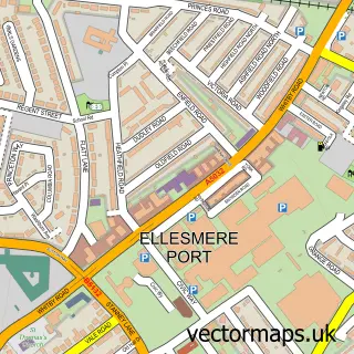
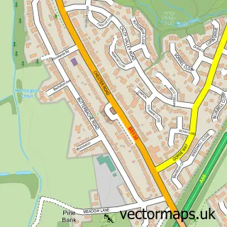
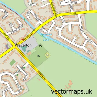
This Great Boughton street map is a detailed vector street map covering a 750m x 750m area. Select a larger area to create and download your own vector street map of Great Boughton.
The 750-metre map sample for Great Boughton covers 525 mapped buildings and approximately 20.1 km of road detail, of which 36 named roads are named. The immediate area includes 11 GP surgeries within 2 miles, 1 pub and 1 MOT station, with 16 within 2 miles. The wider area around Great Boughton features 2 tourism points of interest, 3 food and drink venues and 1 campsite within 2 miles. To create a larger or custom map of Great Boughton, the map builder lets you define your own coverage area and download editable SVG, PDF and PNG files.
Create a larger editable map of Great Boughton
Choose any area you need and generate a high-quality vector map instantly. Perfect for print, planning, design, business and personal use.

This Great Boughton street map in Cheshire is available as downloadable SVG, PDF and PNG map files, or as a printed map for planning, business, display, education, local information and design work. You can also create a larger custom map area using the map selector.
What this Great Boughton map sample shows
Great Boughton lies within Cheshire West And Chester (B) parish, part of Chester City & The Garden Quarter ward in the Cheshire West And Chester (B) local authority area. The postcode geography for this area includes the CH postcode area, the CH3 postcode district and the CH3 5 postcode sector. Residents fall under the Nhs Cheshire And Merseyside Integrated Care Board for NHS services.
Local features near Great Boughton
Within 2 milesAmenities and services in and around Great Boughton.
Administrative and postcode information for Great Boughton
Great Boughton lies within Cheshire West And Chester (B) parish, part of Chester City & The Garden Quarter ward in the Cheshire West And Chester (B) local authority area. The postcode geography for this area includes the CH postcode area, the CH3 postcode district and the CH3 5 postcode sector. Residents fall under the Nhs Cheshire And Merseyside Integrated Care Board for NHS services.
Nearby street map samples around Great Boughton

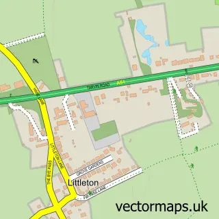
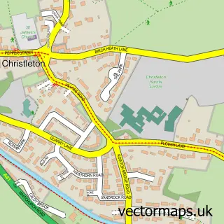
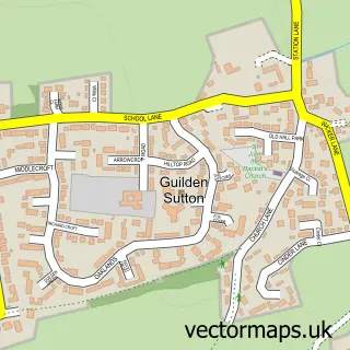
More street maps in Cheshire
750 metre map area coverage
Boundary, postcode and point of interest information for the 750m x 750m rectangle centred on this sample map.
Boundaries containing map centre
Constituency: Chester North and Neston Co Const
District: Cheshire West and Chester (B)
Icb: NHS Cheshire and Merseyside ICB
Parish: Great Boughton CP
Police Force: cheshire
Postcode District: CH3
Postcode Sector: CH3 5
Ward: Great Boughton Ward
Nearby boundaries intersecting sample
Constituency: Chester South and Eddisbury Co Const
Parish: Christleton CP
Postcode Sector: CH3 7
Ward: Christleton & Huntington Ward
Postcode coverage
POI category counts
Contractor: 4
Acupuncture: 3
Building Supply Store: 3
Home Service: 3
Sports Club And League: 3
Accountant: 2
Bakery: 2
Chiropractor: 2
Landscaping: 2
Restaurant: 2
Sample points of interest
- AIMS Accountants for Business
- BiGRoC Accounting Limited
- Anchester Acupuncture
- Anchester Acupuncture
- Tim Spauls Acupuncture
- ColourWheel Art Class Chester
- Hear Pure
- Bluebell Bakery Chester
- Short and Sweet
- The Clubhouse at Chester Boughton Hall
- 1st 4 Nails & Beauty
- Eliminate Ltd
Create a larger editable map of Great Boughton
This sample shows only a 750 metre area. To create a larger map of Great Boughton, use our map builder to choose your own coverage area, add titles and download editable SVG, PDF and PNG files.
Create a custom map of Great Boughton