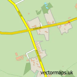
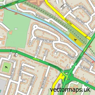
This Saighton street map is a detailed vector street map covering a 750m x 750m area. Select a larger area to create and download your own vector street map of Saighton.
The 750-metre map sample for Saighton covers 58 mapped buildings and approximately 7.7 km of road detail, of which 5 named roads are named. The immediate area includes 2 schools and 1 MOT station within 2 miles. The wider area around Saighton features 1 tourism point of interest and 1 campsite within 2 miles. To create a larger or custom map of Saighton, the map builder lets you define your own coverage area and download editable SVG, PDF and PNG files.
Create a larger editable map of Saighton
Choose any area you need and generate a high-quality vector map instantly. Perfect for print, planning, design, business and personal use.

This Saighton street map in Cheshire is available as downloadable SVG, PDF and PNG map files, or as a printed map for planning, business, display, education, local information and design work. You can also create a larger custom map area using the map selector.
What this Saighton map sample shows
Saighton lies within Aldford And Saighton Cp parish, part of Farndon ward in the Cheshire West And Chester (B) local authority area. The postcode geography for this area includes the CH postcode area, the CH3 postcode district and the CH3 6 postcode sector. Residents fall under the Nhs Cheshire And Merseyside Integrated Care Board for NHS services.
Local features near Saighton
Within 2 milesAmenities and services in and around Saighton.
Administrative and postcode information for Saighton
Saighton lies within Aldford And Saighton Cp parish, part of Farndon ward in the Cheshire West And Chester (B) local authority area. The postcode geography for this area includes the CH postcode area, the CH3 postcode district and the CH3 6 postcode sector. Residents fall under the Nhs Cheshire And Merseyside Integrated Care Board for NHS services.
Nearby street map samples around Saighton
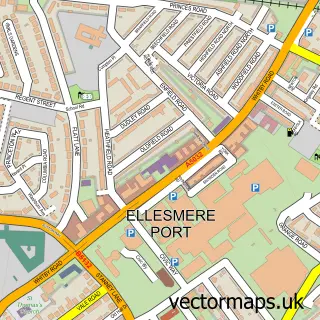

More street maps in Cheshire
750 metre map area coverage
Boundary, postcode and point of interest information for the 750m x 750m rectangle centred on this sample map.
Boundaries containing map centre
Constituency: Chester South and Eddisbury Co Const
District: Cheshire West and Chester (B)
Icb: NHS Cheshire and Merseyside ICB
Parish: Aldford and Saighton CP
Police Force: cheshire
Postcode District: CH3
Postcode Sector: CH3 6
Ward: Farndon Ward
Nearby boundaries intersecting sample
No additional intersecting boundaries found.
Postcode coverage
POI category counts
Architect: 2
Elementary School: 2
Amateur Sports Team: 1
College University: 1
Community Center: 1
Cosmetic And Beauty Supplies: 1
Doctor: 1
Hvac Supplier: 1
Landmark And Historical Building: 1
Photographer: 1
Sample points of interest
- Chester Hockey Club
- McCormick Architecture
- McCormick Architecture
- Abbey Gate College
- Saighton Village Hall
- Simply Gentle
- Clinica Suhair
- Saighton C of E Primary School
- Saighton C of E Primary School
- Clayton And Conroy Plumbing And Heating Contractors
- Saighton Grange
- Joe Jord
Create a larger editable map of Saighton
This sample shows only a 750 metre area. To create a larger map of Saighton, use our map builder to choose your own coverage area, add titles and download editable SVG, PDF and PNG files.
Create a custom map of Saighton