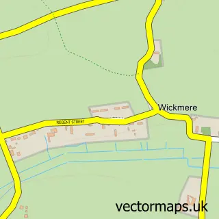
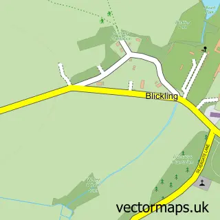
This Erpingham street map is a detailed vector street map covering a 750m x 750m area. Select a larger area to create and download your own vector street map of Erpingham.
The 750-metre map sample for Erpingham covers 200 mapped buildings and approximately 9.7 km of road detail, of which 9 named roads are named. The immediate area includes 1 GP surgery within 2 miles, 1 pub and 1 MOT station within 2 miles. The wider area around Erpingham features 2 food and drink venues. To create a larger or custom map of Erpingham, the map builder lets you define your own coverage area and download editable SVG, PDF and PNG files.
Create a larger editable map of Erpingham
Choose any area you need and generate a high-quality vector map instantly. Perfect for print, planning, design, business and personal use.

This Erpingham street map in Norfolk is available as downloadable SVG, PDF and PNG map files, or as a printed map for planning, business, display, education, local information and design work. You can also create a larger custom map area using the map selector.
What this Erpingham map sample shows
Erpingham lies within Erpingham Cp parish, part of Erpingham ward in the North Norfolk District local authority area. The postcode geography for this area includes the NR postcode area, the NR11 postcode district and the NR11 7 postcode sector. Residents fall under the Nhs Norfolk And Waveney Integrated Care Board for NHS services.
Local features near Erpingham
Within 2 milesAmenities and services in and around Erpingham.
Administrative and postcode information for Erpingham
The local authority covering Erpingham is North Norfolk District, within the county of Norfolk. The settlement lies within Erpingham ward and Erpingham Cp civil parish. The NR11 postcode district and NR11 7 postcode sector serve the immediate area. NHS provision in the area is delivered through Norfolk And Norwich University Hospitals Nhs Foundation Trust.
Nearby street map samples around Erpingham

More street maps in Norfolk
750 metre map area coverage
Boundary, postcode and point of interest information for the 750m x 750m rectangle centred on this sample map.
Boundaries containing map centre
Constituency: North Norfolk Co Const
County: Norfolk County
District: North Norfolk District
Icb: NHS Norfolk and Waveney ICB
Parish: Erpingham CP
Police Force: norfolk
Postcode District: NR11
Postcode Sector: NR11 7
Ward: Erpingham Ward
Nearby boundaries intersecting sample
Parish: Alby with Thwaite CP
Postcode coverage
POI category counts
Building Supply Store: 1
Business Manufacturing And Supply: 1
Day Care Preschool: 1
Education: 1
Printing Equipment And Supply: 1
Professional Services: 1
Pub: 1
Restaurant: 1
Yoga Studio: 1
Sample points of interest
- Ridyards Ltd
- Arc Oil And Gas Ltd
- Little Brown Hare Pre-School
- Erpingham V C Primary School
- Jetprint
- Anglia Clay Supplies
- The Spread Eagle
- Pig at the Pub
- Yoga with Pia
Create a larger editable map of Erpingham
This sample shows only a 750 metre area. To create a larger map of Erpingham, use our map builder to choose your own coverage area, add titles and download editable SVG, PDF and PNG files.
Create a custom map of Erpingham