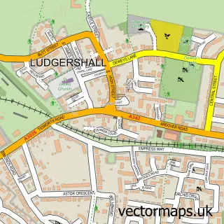
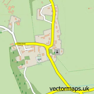
This Faberstown street map is a detailed vector street map covering a 750m x 750m area. Select a larger area to create and download your own vector street map of Faberstown.
The 750-metre map sample for Faberstown covers 179 mapped buildings and approximately 9.3 km of road detail, of which 9 named roads are named. The immediate area includes 1 GP surgery within 2 miles and 2 MOT stations within 2 miles. The wider area around Faberstown features 1 tourism point of interest. To create a larger or custom map of Faberstown, the map builder lets you define your own coverage area and download editable SVG, PDF and PNG files.
Create a larger editable map of Faberstown
Choose any area you need and generate a high-quality vector map instantly. Perfect for print, planning, design, business and personal use.

This Faberstown street map in Hampshire is available as downloadable SVG, PDF and PNG map files, or as a printed map for planning, business, display, education, local information and design work. You can also create a larger custom map area using the map selector.
What this Faberstown map sample shows
Faberstown lies within Ludgershall Cp parish, part of Ludgershall And Perham Down ward in the Wiltshire local authority area. The postcode geography for this area includes the SP postcode area, the SP11 postcode district and the SP11 9 postcode sector. Residents fall under the Nhs Bath And North East Somerset, Swindon And Wiltshire Integrated Care Board for NHS services.
Local features near Faberstown
Within 2 milesAmenities and services in and around Faberstown.
Administrative and postcode information for Faberstown
Faberstown lies within Ludgershall Cp parish, part of Ludgershall And Perham Down ward in the Wiltshire local authority area. The postcode geography for this area includes the SP postcode area, the SP11 postcode district and the SP11 9 postcode sector. Residents fall under the Nhs Bath And North East Somerset, Swindon And Wiltshire Integrated Care Board for NHS services.
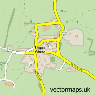
Nearby street map samples around Faberstown

More street maps in Hampshire
750 metre map area coverage
Boundary, postcode and point of interest information for the 750m x 750m rectangle centred on this sample map.
Boundaries containing map centre
Constituency: Romsey and Southampton North Co Const
County: Hampshire County
District: Test Valley District
Icb: NHS Hampshire and Isle of Wight ICB
Parish: Kimpton CP
Police Force: hampshire
Postcode District: SP11
Postcode Sector: SP11 9
Ward: Bellinger Ward
Nearby boundaries intersecting sample
Constituency: East Wiltshire Co Const
District: Wiltshire
Icb: NHS Bath and North East Somerset Swindon and Wiltshire ICB
Parish: Ludgershall CP
Police Force: wiltshire
Postcode coverage
POI category counts
Automotive Repair: 3
Automotive Services And Repair: 1
Chemical Plant: 1
Contractor: 1
Convenience Store: 1
Driving School: 1
Education: 1
Gas Station: 1
Home Decor: 1
Landmark And Historical Building: 1
Sample points of interest
- EJ Services
- Ludgershall Auto Centre
- Multi Service Centre
- ARJ Auto servies
- Gerrish Fuels
- Hart Driveways
- Nisa Local
- driveJohnson's | Driving Lessons Andover
- Strongmind Resiliency Training
- Paddock Service Station
- Faber Laser Co. - Laser Cutting & Engraving Services
- Faberstown
Create a larger editable map of Faberstown
This sample shows only a 750 metre area. To create a larger map of Faberstown, use our map builder to choose your own coverage area, add titles and download editable SVG, PDF and PNG files.
Create a custom map of Faberstown