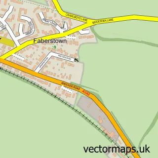
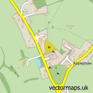
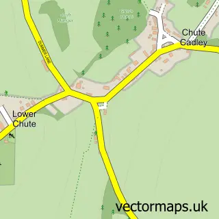
This Ludgershall street map is a detailed vector street map covering a 750m x 750m area. Select a larger area to create and download your own vector street map of Ludgershall.
The 750-metre map sample for Ludgershall covers 463 mapped buildings and approximately 19.3 km of road detail, of which 53 named roads are named. The immediate area includes 1 GP surgery, 4 pubs and 1 MOT station, with 2 within 2 miles. The wider area around Ludgershall features 4 tourism points of interest and 7 food and drink venues. To create a larger or custom map of Ludgershall, the map builder lets you define your own coverage area and download editable SVG, PDF and PNG files.
Create a larger editable map of Ludgershall
Choose any area you need and generate a high-quality vector map instantly. Perfect for print, planning, design, business and personal use.

This Ludgershall street map in Wiltshire is available as downloadable SVG, PDF and PNG map files, or as a printed map for planning, business, display, education, local information and design work. You can also create a larger custom map area using the map selector.
What this Ludgershall map sample shows
Ludgershall lies within Ludgershall Cp parish, part of Ludgershall And Perham Down ward in the Wiltshire local authority area. The postcode geography for this area includes the SP postcode area, the SP11 postcode district and the SP11 9 postcode sector. Residents fall under the Nhs Bath And North East Somerset, Swindon And Wiltshire Integrated Care Board for NHS services.
Local features near Ludgershall
Within 2 milesAmenities and services in and around Ludgershall.
Administrative and postcode information for Ludgershall
Ludgershall lies within Ludgershall Cp parish, part of Ludgershall And Perham Down ward in the Wiltshire local authority area. The postcode geography for this area includes the SP postcode area, the SP11 postcode district and the SP11 9 postcode sector. Residents fall under the Nhs Bath And North East Somerset, Swindon And Wiltshire Integrated Care Board for NHS services.
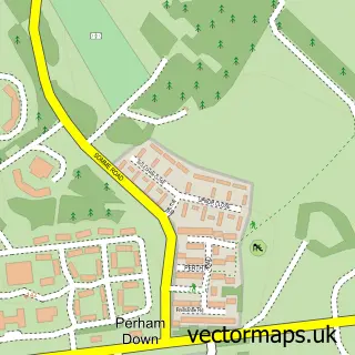
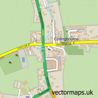
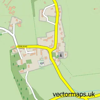
Nearby street map samples around Ludgershall

More street maps in Wiltshire
750 metre map area coverage
Boundary, postcode and point of interest information for the 750m x 750m rectangle centred on this sample map.
Boundaries containing map centre
Constituency: East Wiltshire Co Const
District: Wiltshire
Icb: NHS Bath and North East Somerset Swindon and Wiltshire ICB
Parish: Ludgershall CP
Police Force: wiltshire
Postcode District: SP11
Postcode Sector: SP11 9
Nearby boundaries intersecting sample
No additional intersecting boundaries found.
Postcode coverage
POI category counts
Pub: 4
Automotive Repair: 3
Beauty Salon: 3
Convenience Store: 3
Doctor: 3
Barber: 2
Butcher Shop: 2
Cafe: 2
Church Cathedral: 2
Library: 2
Sample points of interest
- A Total Balance Limited
- The Cooperative Food Ludgershall, Ludgershall
- Ludgershall Castle Car Wash
- Crown Car Service Centre
- G.P. Lillywhite & Sons
- Weyhill Tyres
- Jackie’s hairdressing at the ludgershall barber shop
- Ludgershall FADE Station
- Witchn Hair & Beauty at Salon DeLyla
- Enhance HBT
- Salon DeLyla
- The Wakkie Hair Co.- Charli
Create a larger editable map of Ludgershall
This sample shows only a 750 metre area. To create a larger map of Ludgershall, use our map builder to choose your own coverage area, add titles and download editable SVG, PDF and PNG files.
Create a custom map of Ludgershall