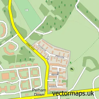
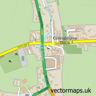
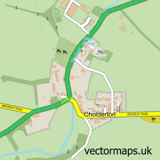
This Tidworth street map is a detailed vector street map covering a 750m x 750m area. Select a larger area to create and download your own vector street map of Tidworth.
The 750-metre map sample for Tidworth covers 213 mapped buildings and approximately 16.9 km of road detail, of which 33 named roads are named. The immediate area includes 2 schools and 2 MOT stations, with 3 within 2 miles. The wider area around Tidworth features 3 tourism points of interest and 3 food and drink venues. To create a larger or custom map of Tidworth, the map builder lets you define your own coverage area and download editable SVG, PDF and PNG files.
Create a larger editable map of Tidworth
Choose any area you need and generate a high-quality vector map instantly. Perfect for print, planning, design, business and personal use.

This Tidworth street map in Wiltshire is available as downloadable SVG, PDF and PNG map files, or as a printed map for planning, business, display, education, local information and design work. You can also create a larger custom map area using the map selector.
What this Tidworth map sample shows
Tidworth lies within Tidworth Cp parish, part of Tidworth ward in the Wiltshire local authority area. The postcode geography for this area includes the SP postcode area, the SP9 postcode district and the SP9 7 postcode sector. Residents fall under the Nhs Bath And North East Somerset, Swindon And Wiltshire Integrated Care Board for NHS services.
Local features near Tidworth
Within 2 milesAmenities and services in and around Tidworth.
Administrative and postcode information for Tidworth
Tidworth lies within Tidworth Cp parish, part of Tidworth ward in the Wiltshire local authority area. The postcode geography for this area includes the SP postcode area, the SP9 postcode district and the SP9 7 postcode sector. Residents fall under the Nhs Bath And North East Somerset, Swindon And Wiltshire Integrated Care Board for NHS services.
Nearby street map samples around Tidworth

More street maps in Wiltshire
750 metre map area coverage
Boundary, postcode and point of interest information for the 750m x 750m rectangle centred on this sample map.
Boundaries containing map centre
Constituency: East Wiltshire Co Const
District: Wiltshire
Icb: NHS Bath and North East Somerset Swindon and Wiltshire ICB
Parish: Tidworth CP
Police Force: wiltshire
Postcode District: SP9
Postcode Sector: SP9 7
Nearby boundaries intersecting sample
No additional intersecting boundaries found.
Postcode coverage
POI category counts
Beauty Salon: 7
Convenience Store: 5
Hair Salon: 4
Cafe: 3
Doctor: 3
Gas Station: 3
Home Service: 3
Preschool: 3
Chinese Restaurant: 2
Church Cathedral: 2
Sample points of interest
- Acupuncture Associates
- Rexel
- Cavanfields UK
- MOT Super Centre Ltd
- Greggs
- Jiggaz Grill
- soldier_barber
- Serenity Hair
- Beauty by Dolls
- Bespoke Hair & Beauty
- Divine Glory Beauty and Spa
- Dolled by Ellie Jade
Create a larger editable map of Tidworth
This sample shows only a 750 metre area. To create a larger map of Tidworth, use our map builder to choose your own coverage area, add titles and download editable SVG, PDF and PNG files.
Create a custom map of Tidworth