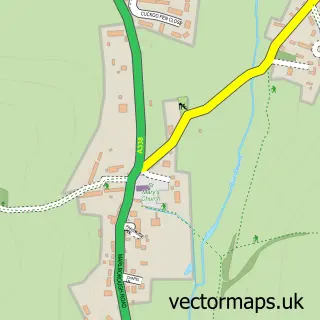
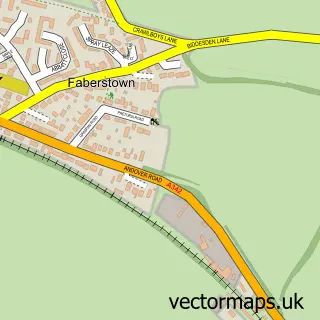
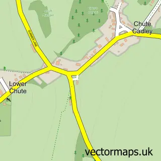
This Collingbourne Ducis street map is a detailed vector street map covering a 750m x 750m area. Select a larger area to create and download your own vector street map of Collingbourne Ducis.
The 750-metre map sample for Collingbourne Ducis covers 188 mapped buildings and approximately 8.2 km of road detail, of which 13 named roads are named. The immediate area includes 1 school, 2 pubs and 1 MOT station within 2 miles. The wider area around Collingbourne Ducis features 2 food and drink venues. To create a larger or custom map of Collingbourne Ducis, the map builder lets you define your own coverage area and download editable SVG, PDF and PNG files.
Create a larger editable map of Collingbourne Ducis
Choose any area you need and generate a high-quality vector map instantly. Perfect for print, planning, design, business and personal use.

This Collingbourne Ducis street map in Wiltshire is available as downloadable SVG, PDF and PNG map files, or as a printed map for planning, business, display, education, local information and design work. You can also create a larger custom map area using the map selector.
What this Collingbourne Ducis map sample shows
Collingbourne Ducis lies within Collingbourne Ducis Cp parish, part of The Collingbournes And Netheravon ward in the Wiltshire local authority area. The postcode geography for this area includes the SN postcode area, the SN8 postcode district and the SN8 3 postcode sector. Residents fall under the Nhs Bath And North East Somerset, Swindon And Wiltshire Integrated Care Board for NHS services.
Local features near Collingbourne Ducis
Within 2 milesAmenities and services in and around Collingbourne Ducis.
Administrative and postcode information for Collingbourne Ducis
Collingbourne Ducis lies within Collingbourne Ducis Cp parish, part of The Collingbournes And Netheravon ward in the Wiltshire local authority area. The postcode geography for this area includes the SN postcode area, the SN8 postcode district and the SN8 3 postcode sector. Residents fall under the Nhs Bath And North East Somerset, Swindon And Wiltshire Integrated Care Board for NHS services.
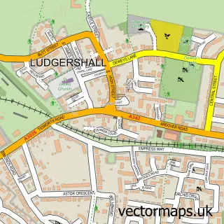
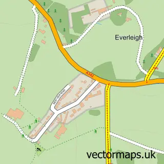
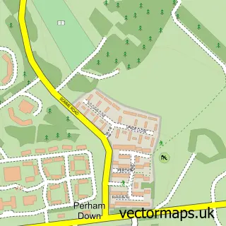
Nearby street map samples around Collingbourne Ducis

More street maps in Wiltshire
750 metre map area coverage
Boundary, postcode and point of interest information for the 750m x 750m rectangle centred on this sample map.
Boundaries containing map centre
Constituency: East Wiltshire Co Const
District: Wiltshire
Icb: NHS Bath and North East Somerset Swindon and Wiltshire ICB
Parish: Collingbourne Ducis CP
Police Force: wiltshire
Postcode District: SN8
Postcode Sector: SN8 3
Nearby boundaries intersecting sample
No additional intersecting boundaries found.
Postcode coverage
POI category counts
Automotive Repair: 3
Professional Services: 3
Korean Grocery Store: 2
Pub: 2
Advertising Agency: 1
Auto Customization: 1
Beauty And Spa: 1
Convenience Store: 1
Elementary School: 1
Farming Services: 1
Sample points of interest
- Third Wave Communications
- Guzzlers Custom and Sports Cars
- Black Smoke
- Prestige and Performance Cars
- Pug Performance Motorsport
- Skinology by Dr Anna
- Collingbourne Stores
- Collingbourne Church of England Primary School
- A T S S Ltd.
- W. Taylor (frames) Ltd.
- Bourne Furniture
- Design Write
Create a larger editable map of Collingbourne Ducis
This sample shows only a 750 metre area. To create a larger map of Collingbourne Ducis, use our map builder to choose your own coverage area, add titles and download editable SVG, PDF and PNG files.
Create a custom map of Collingbourne Ducis