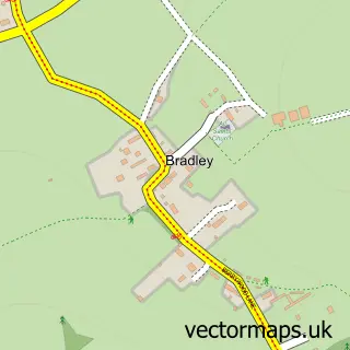
This Farleigh Wallop street map is a detailed vector street map covering a 750m x 750m area. Select a larger area to create and download your own vector street map of Farleigh Wallop.
The 750-metre map sample for Farleigh Wallop covers 24 mapped buildings and approximately 5.9 km of road detail, of which 3 named roads are named. The immediate area includes 1 GP surgery within 2 miles and 2 MOT stations within 2 miles. The wider area around Farleigh Wallop features 1 tourism point of interest and 1 hotel. To create a larger or custom map of Farleigh Wallop, the map builder lets you define your own coverage area and download editable SVG, PDF and PNG files.
Create a larger editable map of Farleigh Wallop
Choose any area you need and generate a high-quality vector map instantly. Perfect for print, planning, design, business and personal use.

This Farleigh Wallop street map in Hampshire is available as downloadable SVG, PDF and PNG map files, or as a printed map for planning, business, display, education, local information and design work. You can also create a larger custom map area using the map selector.
What this Farleigh Wallop map sample shows
Farleigh Wallop lies within Farleigh Wallop Cp parish, part of Upton Grey And The Candovers ward in the Basingstoke And Deane District (B) local authority area. The postcode geography for this area includes the RG postcode area, the RG25 postcode district and the RG25 2 postcode sector. Residents fall under the Nhs Hampshire And Isle Of Wight Integrated Care Board for NHS services.
Local features near Farleigh Wallop
Within 2 milesAmenities and services in and around Farleigh Wallop.
Administrative and postcode information for Farleigh Wallop
The local authority covering Farleigh Wallop is Basingstoke And Deane District (B), within the county of Hampshire. The settlement lies within Upton Grey And The Candovers ward and Farleigh Wallop Cp civil parish. The RG25 postcode district and RG25 2 postcode sector serve the immediate area. NHS provision in the area is delivered through Hampshire Hospitals Nhs Foundation Trust.
Nearby street map samples around Farleigh Wallop


More street maps in Hampshire
750 metre map area coverage
Boundary, postcode and point of interest information for the 750m x 750m rectangle centred on this sample map.
Boundaries containing map centre
Constituency: East Hampshire Co Const
County: Hampshire County
District: Basingstoke and Deane District (B)
Icb: NHS Hampshire and Isle of Wight ICB
Parish: Farleigh Wallop CP
Police Force: hampshire
Postcode District: RG25
Postcode Sector: RG25 2
Ward: Oakley & The Candovers Ward
Nearby boundaries intersecting sample
No additional intersecting boundaries found.
Postcode coverage
POI category counts
Beauty Salon: 1
Campground: 1
Hair Salon: 1
Hotel: 1
Marketing Agency: 1
Massage Therapy: 1
Property Management: 1
Social Service Organizations: 1
Sample points of interest
- Tigerda hair
- Inwood Camping
- D'Luxe Salon
- Farleigh House LLP
- Dolia
- Fuschia Therapy
- Trustees of the Portsmouth Estates
- Farleigh Wallop Estate Club
Create a larger editable map of Farleigh Wallop
This sample shows only a 750 metre area. To create a larger map of Farleigh Wallop, use our map builder to choose your own coverage area, add titles and download editable SVG, PDF and PNG files.
Create a custom map of Farleigh Wallop