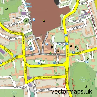
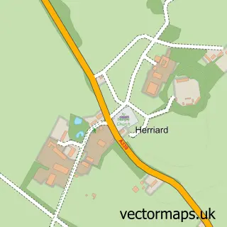
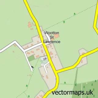
This Cliddesden street map is a detailed vector street map covering a 750m x 750m area. Select a larger area to create and download your own vector street map of Cliddesden.
The 750-metre map sample for Cliddesden covers 179 mapped buildings and approximately 18.6 km of road detail, of which 8 named roads are named. The immediate area includes 3 GP surgeries within 2 miles, 2 pubs and 1 MOT station, with 13 within 2 miles. The wider area around Cliddesden features 2 food and drink venues. To create a larger or custom map of Cliddesden, the map builder lets you define your own coverage area and download editable SVG, PDF and PNG files.
Create a larger editable map of Cliddesden
Choose any area you need and generate a high-quality vector map instantly. Perfect for print, planning, design, business and personal use.

This Cliddesden street map in Hampshire is available as downloadable SVG, PDF and PNG map files, or as a printed map for planning, business, display, education, local information and design work. You can also create a larger custom map area using the map selector.
What this Cliddesden map sample shows
Cliddesden lies within Cliddesden Cp parish, part of Upton Grey And The Candovers ward in the Basingstoke And Deane District (B) local authority area. The postcode geography for this area includes the RG postcode area, the RG25 postcode district and the RG25 2 postcode sector. Residents fall under the Nhs Hampshire And Isle Of Wight Integrated Care Board for NHS services.
Local features near Cliddesden
Within 2 milesAmenities and services in and around Cliddesden.
Administrative and postcode information for Cliddesden
Cliddesden lies within Cliddesden Cp parish, part of Upton Grey And The Candovers ward in the Basingstoke And Deane District (B) local authority area. The postcode geography for this area includes the RG postcode area, the RG25 postcode district and the RG25 2 postcode sector. Residents fall under the Nhs Hampshire And Isle Of Wight Integrated Care Board for NHS services.
Nearby street map samples around Cliddesden

More street maps in Hampshire
750 metre map area coverage
Boundary, postcode and point of interest information for the 750m x 750m rectangle centred on this sample map.
Boundaries containing map centre
Constituency: North East Hampshire Co Const
County: Hampshire County
District: Basingstoke and Deane District (B)
Icb: NHS Hampshire and Isle of Wight ICB
Parish: Cliddesden CP
Police Force: hampshire
Postcode District: RG25
Postcode Sector: RG25 2
Ward: Basing & Upton Grey Ward
Nearby boundaries intersecting sample
Constituency: Basingstoke Boro Const
Postcode District: RG22
Postcode Sector: RG22 4
Postcode coverage
POI category counts
Pet Groomer: 3
Marketing Agency: 2
Pub: 2
Advertising Agency: 1
Agricultural Production: 1
Church Cathedral: 1
Community Center: 1
Contractor: 1
Hair Salon: 1
International Business And Trade Services: 1
Sample points of interest
- Datasharp Independent Solutions
- Janaway J G & Sons
- St Leonard's Church
- Cliddesden Millennium Village Hall
- Pro-build
- Studio 5 - Hair & Beauty
- Convert A Loft
- React Technologies
- Imagination Design Ltd.
- Bang Communications
- Keb Marketing Services Ltd.
- Clear Signal Communication
Create a larger editable map of Cliddesden
This sample shows only a 750 metre area. To create a larger map of Cliddesden, use our map builder to choose your own coverage area, add titles and download editable SVG, PDF and PNG files.
Create a custom map of Cliddesden