Vector Maps logo
Home Why it works Popular maps Districts Samples Customizer Create Your Map
VectorMaps.uk
Home Popular maps Districts Samples Customizer Create Your Map Privacy Disclaimer
Home / UK Maps / Bedfordshire / Farndish Map

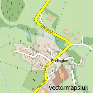
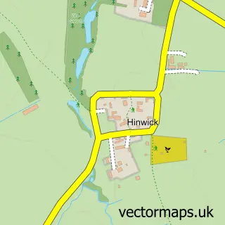
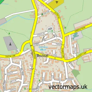
This Farndish street map is a detailed vector street map covering a 750m x 750m area. Select a larger area to create and download your own vector street map of Farndish.

Farndish is a village in Bedfordshire, in the Eastern of England. The settlement falls within the North East Bedfordshire parliamentary constituency. It is served by the NN29 postcode district, with NN29 7 as the local postcode sector.

The 750-metre map sample for Farndish covers 40 mapped buildings and approximately 7.4 km of road detail, of which 1 named road are named. The immediate area includes 1 GP surgery within 2 miles and 1 MOT station within 2 miles. To create a larger or custom map of Farndish, the map builder lets you define your own coverage area and download editable SVG, PDF and PNG files.

40Buildings
7.36 kmRoads
1Named roads
4,920Residents within 2 miles
Create your own

Create a larger editable map of Farndish

Choose any area you need and generate a high-quality vector map instantly. Perfect for print, planning, design, business and personal use.

Choose any location
Editable SVG files
Any size up to A0
PDF, PNG & more
Instant download
High quality guaranteed
Create My Custom Map
Secure, private & no credit card required
Farndish Vector Street Map
750m Sample
Farndish vector street map sample showing roads, buildings and local features in a 750 metre preview area
Buy Farndish Map Print from £12.95 Buy Farndish Digital Map from £6

This Farndish street map in Bedfordshire is available as downloadable SVG, PDF and PNG map files, or as a printed map for planning, business, display, education, local information and design work. You can also create a larger custom map area using the map selector.

What this Farndish map sample shows

Farndish lies within Podington Cp parish, part of Harrold ward in the Bedford (B) local authority area. The postcode geography for this area includes the NN postcode area, the NN29 postcode district and the NN29 7 postcode sector. Residents fall under the Nhs Bedfordshire, Luton And Milton Keynes Integrated Care Board for NHS services.

Local features near Farndish

Within 2 miles

Amenities and services in and around Farndish.

1 GP surgeries within 2 miles
1 MOT stations within 2 miles

Counts are approximate and based on publicly available data.

Administrative and postcode information for Farndish

The local authority covering Farndish is Bedford (B), within the county of Bedfordshire. The settlement lies within Harrold ward and Podington Cp civil parish. The NN29 postcode district and NN29 7 postcode sector serve the immediate area. NHS provision in the area is delivered through Bedfordshire Hospitals Nhs Foundation Trust.

Parish Podington CP
Ward Harrold
District / local authority Bedford (B)
County Bedfordshire
Historic county Bedfordshire
Postcode district NN29
Postcode sector NN29 7
Parliamentary constituency North East Bedfordshire
Region Eastern
Country England

Nearby street map samples around Farndish

Street map sample of Rushden, Northamptonshire Rushden Town - Northamptonshire - 2.7 miles Street map sample of Milton Keynes, Buckinghamshire Milton Keynes City - Buckinghamshire - 16.2 miles Street map sample of Podington, Bedfordshire Podington Village - Bedfordshire - 1.0 miles Street map sample of Irchester, Northamptonshire Irchester Village - Northamptonshire - 1.3 miles Street map sample of Wollaston, Northamptonshire Wollaston Village - Northamptonshire - 1.3 miles Street map sample of Hinwick, Bedfordshire Hinwick Village - Bedfordshire - 1.4 miles Street map sample of Wymington, Bedfordshire Wymington Village - Bedfordshire - 1.8 miles Street map sample of Little Irchester, Northamptonshire Little Irchester Village - Northamptonshire - 2.2 miles Street map sample of Great Doddington, Northamptonshire Great Doddington Village - Northamptonshire - 3.0 miles Street map sample of Bozeat, Northamptonshire Bozeat Village - Northamptonshire - 3.1 miles

More street maps in Bedfordshire

Street map sample of Podington, Bedfordshire Podington Village - 1.0 miles Street map sample of Hinwick, Bedfordshire Hinwick Village - 1.4 miles Street map sample of Wymington, Bedfordshire Wymington Village - 1.8 miles Street map sample of Souldrop, Bedfordshire Souldrop Village - 3.8 miles Street map sample of Odell, Bedfordshire Odell Village - 4.3 miles

750 metre map area coverage

Boundary, postcode and point of interest information for the 750m x 750m rectangle centred on this sample map.

Boundaries containing map centre

Constituency: North Bedfordshire Co Const

District: Bedford (B)

Icb: NHS Central East ICB

Parish: Podington CP

Police Force: bedfordshire

Postcode District: NN29

Postcode Sector: NN29 7

Ward: Harrold Ward

Nearby boundaries intersecting sample

No additional intersecting boundaries found.

Postcode coverage

NN29 NN29 7

POI category counts

Professional Services: 2

Auto Body Shop: 1

Brewery: 1

Powder Coating Service: 1

Sample points of interest

  • Dents Heaven Vehicle Body Repairs Auto Body Shop
  • Saxby's Cider Brewery
  • Slamfire Tactical Coatings Powder Coating Service
  • Muddy Matches Professional Services
  • Saxby Cider Professional Services

Create a larger editable map of Farndish

This sample shows only a 750 metre area. To create a larger map of Farndish, use our map builder to choose your own coverage area, add titles and download editable SVG, PDF and PNG files.

Create a custom map of Farndish

Phone 01751 473136 | Copyright Vectormaps.uk 2026

Samples Customizer Privacy Disclaimer
Farndish Vector Street Map
Farndish enlarged street map sample showing a 750 metre preview area