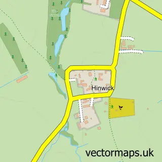
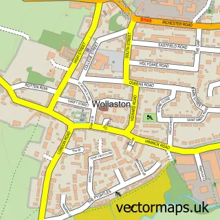
This Wymington street map is a detailed vector street map covering a 750m x 750m area. Select a larger area to create and download your own vector street map of Wymington.
The 750-metre map sample for Wymington covers 166 mapped buildings and approximately 14.7 km of road detail, of which 9 named roads are named. The immediate area includes 1 school, 3 GP surgeries within 2 miles, 1 pub and 6 MOT stations within 2 miles. The wider area around Wymington features 2 food and drink venues. To create a larger or custom map of Wymington, the map builder lets you define your own coverage area and download editable SVG, PDF and PNG files.
Create a larger editable map of Wymington
Choose any area you need and generate a high-quality vector map instantly. Perfect for print, planning, design, business and personal use.

This Wymington street map in Bedfordshire is available as downloadable SVG, PDF and PNG map files, or as a printed map for planning, business, display, education, local information and design work. You can also create a larger custom map area using the map selector.
What this Wymington map sample shows
Wymington lies within Wymington Cp parish, part of Harrold ward in the Bedford (B) local authority area. The postcode geography for this area includes the NN postcode area, the NN10 postcode district and the NN10 9 postcode sector. Residents fall under the Nhs Bedfordshire, Luton And Milton Keynes Integrated Care Board for NHS services.
Local features near Wymington
Within 2 milesAmenities and services in and around Wymington.
Administrative and postcode information for Wymington
Wymington lies within Wymington Cp parish, part of Harrold ward in the Bedford (B) local authority area. The postcode geography for this area includes the NN postcode area, the NN10 postcode district and the NN10 9 postcode sector. Residents fall under the Nhs Bedfordshire, Luton And Milton Keynes Integrated Care Board for NHS services.
Nearby street map samples around Wymington

More street maps in Bedfordshire
750 metre map area coverage
Boundary, postcode and point of interest information for the 750m x 750m rectangle centred on this sample map.
Boundaries containing map centre
Constituency: North Bedfordshire Co Const
District: Bedford (B)
Icb: NHS Central East ICB
Parish: Wymington CP
Police Force: bedfordshire
Postcode District: NN10
Postcode Sector: NN10 9
Ward: Harrold Ward
Nearby boundaries intersecting sample
No additional intersecting boundaries found.
Postcode coverage
POI category counts
Anglican Church: 2
Bus Service: 1
Church Cathedral: 1
Counseling And Mental Health: 1
Education: 1
Elementary School: 1
Jewelry Store: 1
Oil And Gas Field Equipment And Services: 1
Pub: 1
Rental Kiosks: 1
Sample points of interest
- Church of St Lawrence
- St Lawrence
- Finestyle Coaches
- The Churches of Wymington
- John Michael Knight
- St Lawrence VA Lower School
- St Lawrence VA Primary School
- Pandora
- Directional Drilling Services (U K) Ltd.
- The New Inn
- K.G.Patel & Sons Ltd @ Souldrop Service Station
- Replete Flatbreads
Create a larger editable map of Wymington
This sample shows only a 750 metre area. To create a larger map of Wymington, use our map builder to choose your own coverage area, add titles and download editable SVG, PDF and PNG files.
Create a custom map of Wymington