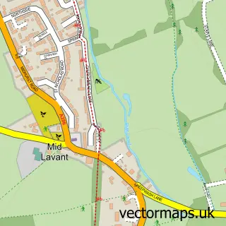
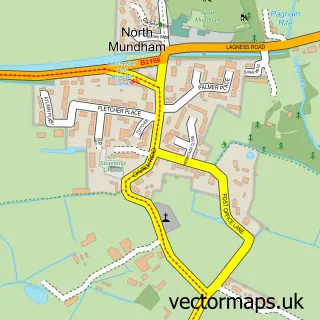
This Fishbourne street map is a detailed vector street map covering a 750m x 750m area. Select a larger area to create and download your own vector street map of Fishbourne.
The 750-metre map sample for Fishbourne covers 389 mapped buildings and approximately 11.9 km of road detail, of which 25 named roads are named. The immediate area includes 1 school, 1 railway station, 4 GP surgeries within 2 miles and 10 MOT stations within 2 miles. The wider area around Fishbourne features 2 tourism points of interest, 1 food and drink venue and 2 campsites within 2 miles. To create a larger or custom map of Fishbourne, the map builder lets you define your own coverage area and download editable SVG, PDF and PNG files.
Create a larger editable map of Fishbourne
Choose any area you need and generate a high-quality vector map instantly. Perfect for print, planning, design, business and personal use.

This Fishbourne street map in West Sussex is available as downloadable SVG, PDF and PNG map files, or as a printed map for planning, business, display, education, local information and design work. You can also create a larger custom map area using the map selector.
What this Fishbourne map sample shows
Fishbourne lies within Fishbourne Cp parish, part of Harbour Villages ward in the Chichester District local authority area. The postcode geography for this area includes the PO postcode area, the PO19 postcode district and the PO19 3 postcode sector. Residents fall under the Nhs Sussex Integrated Care Board for NHS services.
Local features near Fishbourne
Within 2 milesAmenities and services in and around Fishbourne.
Administrative and postcode information for Fishbourne
Fishbourne lies within Fishbourne Cp parish, part of Harbour Villages ward in the Chichester District local authority area. The postcode geography for this area includes the PO postcode area, the PO19 postcode district and the PO19 3 postcode sector. Residents fall under the Nhs Sussex Integrated Care Board for NHS services.
Nearby street map samples around Fishbourne

More street maps in West Sussex
750 metre map area coverage
Boundary, postcode and point of interest information for the 750m x 750m rectangle centred on this sample map.
Boundaries containing map centre
Constituency: Chichester Co Const
County: West Sussex County
District: Chichester District
Icb: NHS Surrey and Sussex ICB
Parish: Fishbourne CP
Police Force: sussex
Postcode District: PO19
Postcode Sector: PO19 3
Ward: Harbour Villages Ward
Nearby boundaries intersecting sample
Parish: Chichester CP
Postcode District: PO18
Postcode Sector: PO18 8
Ward: Chichester West Ward
Postcode coverage
POI category counts
Community Center: 3
Accountant: 1
Alternative Medicine: 1
Arts And Crafts: 1
Auto Upholstery: 1
Automotive Services And Repair: 1
B2b Scientific Equipment: 1
Beauty And Spa: 1
Beauty Salon: 1
Bicycle Shop: 1
Sample points of interest
- The Fishbourne Accountant
- Simon Palmer
- The Pottery Corner
- Jerry Groome Re Upholstery
- Fishbourne Garden Machinery
- Micropix Ltd.
- The Powder Room
- The Powder Room
- Cranked Cycles
- Premier Window Films
- Car's Catering Services
- Riverside Cafe Tea Room & Gardens
Create a larger editable map of Fishbourne
This sample shows only a 750 metre area. To create a larger map of Fishbourne, use our map builder to choose your own coverage area, add titles and download editable SVG, PDF and PNG files.
Create a custom map of Fishbourne