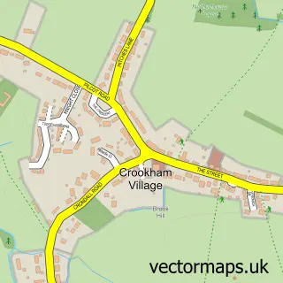
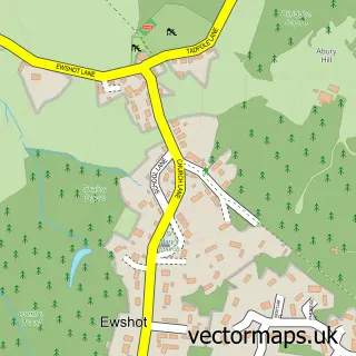
This Fleet street map is a detailed vector street map covering a 750m x 750m area. Select a larger area to create and download your own vector street map of Fleet.
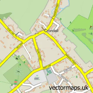
The 750-metre map sample for Fleet covers 493 mapped buildings and approximately 16.6 km of road detail, of which 29 named roads are named. The immediate area includes 2 GP surgeries within 2 miles, 7 pubs and 1 MOT station, with 9 within 2 miles. The wider area around Fleet features 2 tourism points of interest, 25 food and drink venues and 2 hotels. To create a larger or custom map of Fleet, the map builder lets you define your own coverage area and download editable SVG, PDF and PNG files.
Create a larger editable map of Fleet
Choose any area you need and generate a high-quality vector map instantly. Perfect for print, planning, design, business and personal use.

This Fleet street map in Hampshire is available as downloadable SVG, PDF and PNG map files, or as a printed map for planning, business, display, education, local information and design work. You can also create a larger custom map area using the map selector.
What this Fleet map sample shows
Fleet lies within Fleet Cp parish, part of Fleet Central ward in the Hart District local authority area. The postcode geography for this area includes the GU postcode area, the GU51 postcode district and the GU51 5 postcode sector. Residents fall under the Nhs Frimley Integrated Care Board for NHS services.
Local features near Fleet
Within 2 milesAmenities and services in and around Fleet.
Administrative and postcode information for Fleet
Fleet lies within Fleet Cp parish, part of Fleet Central ward in the Hart District local authority area. The postcode geography for this area includes the GU postcode area, the GU51 postcode district and the GU51 5 postcode sector. Residents fall under the Nhs Frimley Integrated Care Board for NHS services.
Nearby street map samples around Fleet

More street maps in Hampshire
750 metre map area coverage
Boundary, postcode and point of interest information for the 750m x 750m rectangle centred on this sample map.
Boundaries containing map centre
Constituency: North East Hampshire Co Const
County: Hampshire County
District: Hart District
Icb: NHS Frimley ICB
Parish: Fleet CP
Police Force: hampshire
Postcode District: GU51
Postcode Sector: GU51 3
Ward: Fleet Central Ward
Nearby boundaries intersecting sample
Postcode Sector: GU51 4, GU51 5
Ward: Fleet East Ward
Postcode coverage
POI category counts
Real Estate Agent: 16
Beauty Salon: 14
Professional Services: 10
Indian Restaurant: 9
Bank Credit Union: 8
Barber: 8
Building Supply Store: 8
Dance School: 8
Dry Cleaning: 8
Jewelry Store: 8
Sample points of interest
- Kirk Rice LLP
- Kyla Phillips Acupuncture
- APM Digital
- Fifty50 Creative
- MSA Markets Media
- Total Marketing Resource
- All Saints C Of E Church
- Fleet: All Saints
- Barnardo's
- British Red Cross
- Phyllis Tuckwell Hospice Charity Shop
- Serendipity Ltd.
Create a larger editable map of Fleet
This sample shows only a 750 metre area. To create a larger map of Fleet, use our map builder to choose your own coverage area, add titles and download editable SVG, PDF and PNG files.
Create a custom map of Fleet