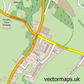
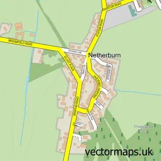
This Glassford street map is a detailed vector street map covering a 750m x 750m area. Select a larger area to create and download your own vector street map of Glassford.
The 750-metre map sample for Glassford covers 214 mapped buildings and approximately 11.2 km of road detail, of which 22 named roads are named. The immediate area includes 3 MOT stations within 2 miles. To create a larger or custom map of Glassford, the map builder lets you define your own coverage area and download editable SVG, PDF and PNG files.
Create a larger editable map of Glassford
Choose any area you need and generate a high-quality vector map instantly. Perfect for print, planning, design, business and personal use.

This Glassford street map in Lanarkshire is available as downloadable SVG, PDF and PNG map files, or as a printed map for planning, business, display, education, local information and design work. You can also create a larger custom map area using the map selector.
What this Glassford map sample shows
Glassford lies within South Lanarkshire parish, part of Avondale And Stonehouse ward in the South Lanarkshire local authority area. The postcode geography for this area includes the ML postcode area, the ML10 postcode district and the ML10 6 postcode sector. Residents fall under the Lanarkshire for NHS services.
Local features near Glassford
Within 2 milesAmenities and services in and around Glassford.
Administrative and postcode information for Glassford
The local authority covering Glassford is South Lanarkshire, within the county of Lanarkshire. The settlement lies within Avondale And Stonehouse ward and South Lanarkshire civil parish. The ML10 postcode district and ML10 6 postcode sector serve the immediate area. NHS provision in the area is delivered through Lanarkshire.
Nearby street map samples around Glassford

More street maps in Lanarkshire
750 metre map area coverage
Boundary, postcode and point of interest information for the 750m x 750m rectangle centred on this sample map.
Boundaries containing map centre
Constituency: East Kilbride and Strathaven Co Const
District: South Lanarkshire
Icb: Lanarkshire
Postcode District: ML10
Postcode Sector: ML10 6
Ward: Avondale and Stonehouse Ward
Nearby boundaries intersecting sample
No additional intersecting boundaries found.
Postcode coverage
POI category counts
Driving School: 2
Professional Services: 2
Arts And Entertainment: 1
Beer Bar: 1
Carpenter: 1
Eat And Drink: 1
Elementary School: 1
Financial Service: 1
Landscaping: 1
Preschool: 1
Sample points of interest
- Glassford Hall
- The Glassford Inn
- Avon Builders
- Alba Driver Training
- Denise Laird Driving School
- Fortune Dragon
- Glassford Primary School
- Neill Co Financial Services
- Kennedy Landscaping Ltd
- Glassford Day Nursery
- Colin Smith Photography
- Les Hoggan Photography
Create a larger editable map of Glassford
This sample shows only a 750 metre area. To create a larger map of Glassford, use our map builder to choose your own coverage area, add titles and download editable SVG, PDF and PNG files.
Create a custom map of Glassford