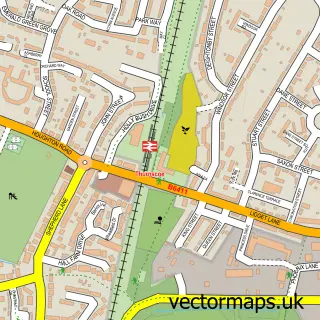
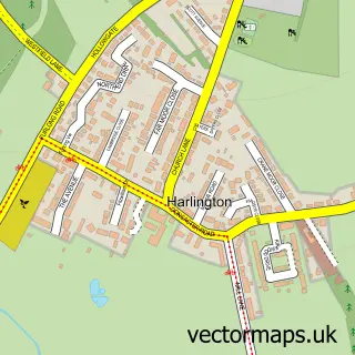
This Goldthorpe street map is a detailed vector street map covering a 750m x 750m area. Select a larger area to create and download your own vector street map of Goldthorpe.
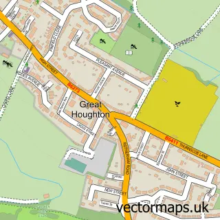
The 750-metre map sample for Goldthorpe covers 360 mapped buildings and approximately 17.9 km of road detail, of which 44 named roads are named. The immediate area includes 2 schools, 4 GP surgeries within 2 miles, 2 pubs and 4 MOT stations within 2 miles. The wider area around Goldthorpe features 9 food and drink venues. To create a larger or custom map of Goldthorpe, the map builder lets you define your own coverage area and download editable SVG, PDF and PNG files.
Create a larger editable map of Goldthorpe
Choose any area you need and generate a high-quality vector map instantly. Perfect for print, planning, design, business and personal use.

This Goldthorpe street map in South Yorkshire is available as downloadable SVG, PDF and PNG map files, or as a printed map for planning, business, display, education, local information and design work. You can also create a larger custom map area using the map selector.
What this Goldthorpe map sample shows
Goldthorpe lies within Barnsley District (B) parish, part of Dearne South ward in the Barnsley District (B) local authority area. The postcode geography for this area includes the S postcode area, the S63 postcode district and the S63 9 postcode sector. Residents fall under the Nhs South Yorkshire Integrated Care Board for NHS services.
Local features near Goldthorpe
Within 2 milesAmenities and services in and around Goldthorpe.
Administrative and postcode information for Goldthorpe
Goldthorpe lies within Barnsley District (B) parish, part of Dearne South ward in the Barnsley District (B) local authority area. The postcode geography for this area includes the S postcode area, the S63 postcode district and the S63 9 postcode sector. Residents fall under the Nhs South Yorkshire Integrated Care Board for NHS services.
Nearby street map samples around Goldthorpe

More street maps in South Yorkshire
750 metre map area coverage
Boundary, postcode and point of interest information for the 750m x 750m rectangle centred on this sample map.
Boundaries containing map centre
Constituency: Barnsley South Co Const
District: Barnsley District (B)
Icb: NHS South Yorkshire ICB
Police Force: south yorkshire
Postcode District: S63
Postcode Sector: S63 9
Ward: Dearne North Ward
Nearby boundaries intersecting sample
Postcode Sector: S63 0
Ward: Dearne South Ward
Postcode coverage
POI category counts
Beauty Salon: 8
Social Service Organizations: 6
Restaurant: 5
Tattoo And Piercing: 4
Banks: 3
Beauty And Spa: 3
Betting Center: 3
Convenience Store: 3
Elementary School: 3
Flowers And Gifts Shop: 3
Sample points of interest
- Goldthorpe
- Workers Educational Association
- St John Evangelist & St Mary Magdelene
- Instock Logos
- Chevin Housing
- ATM (Post Office)
- Cooplands
- Staniforths Rawmarsh
- NatWest
- South Yorkshire Credit Union
- Yorkshire Bank
- The New Bank
Create a larger editable map of Goldthorpe
This sample shows only a 750 metre area. To create a larger map of Goldthorpe, use our map builder to choose your own coverage area, add titles and download editable SVG, PDF and PNG files.
Create a custom map of Goldthorpe