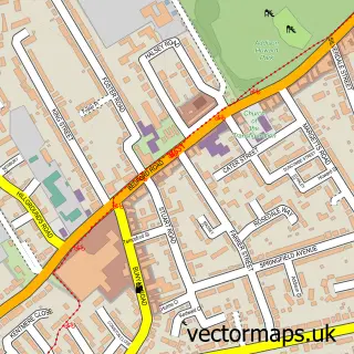
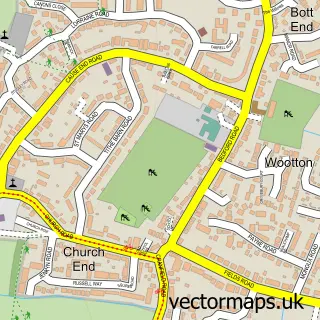
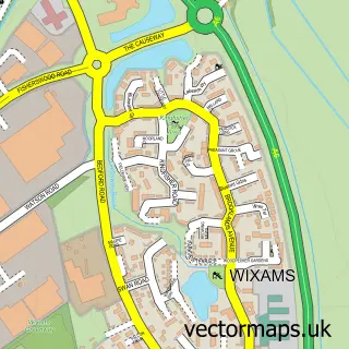
This Great Denham street map is a detailed vector street map covering a 750m x 750m area. Select a larger area to create and download your own vector street map of Great Denham.
The 750-metre map sample for Great Denham covers 597 mapped buildings and approximately 16.7 km of road detail, of which 43 named roads are named. The immediate area includes 5 GP surgeries within 2 miles and 25 MOT stations within 2 miles. The wider area around Great Denham features 1 tourism point of interest and 1 food and drink venue. To create a larger or custom map of Great Denham, the map builder lets you define your own coverage area and download editable SVG, PDF and PNG files.
Create a larger editable map of Great Denham
Choose any area you need and generate a high-quality vector map instantly. Perfect for print, planning, design, business and personal use.

This Great Denham street map in Bedfordshire is available as downloadable SVG, PDF and PNG map files, or as a printed map for planning, business, display, education, local information and design work. You can also create a larger custom map area using the map selector.
What this Great Denham map sample shows
Great Denham lies within Kempston Rural Cp parish, part of Kempston Rural ward in the Bedford (B) local authority area. The postcode geography for this area includes the MK postcode area, the MK43 postcode district and the MK43 8 postcode sector. Residents fall under the Nhs Bedfordshire, Luton And Milton Keynes Integrated Care Board for NHS services.
Local features near Great Denham
Within 2 milesAmenities and services in and around Great Denham.
Administrative and postcode information for Great Denham
Great Denham lies within Kempston Rural Cp parish, part of Kempston Rural ward in the Bedford (B) local authority area. The postcode geography for this area includes the MK postcode area, the MK43 postcode district and the MK43 8 postcode sector. Residents fall under the Nhs Bedfordshire, Luton And Milton Keynes Integrated Care Board for NHS services.
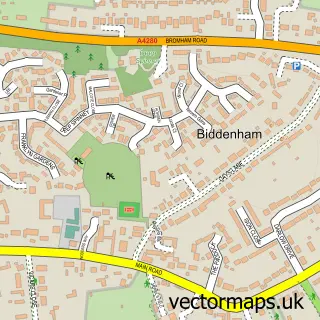
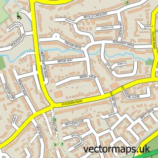
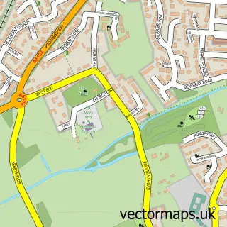
Nearby street map samples around Great Denham

More street maps in Bedfordshire
750 metre map area coverage
Boundary, postcode and point of interest information for the 750m x 750m rectangle centred on this sample map.
Boundaries containing map centre
Constituency: North Bedfordshire Co Const
District: Bedford (B)
Icb: NHS Central East ICB
Parish: Great Denham CP
Police Force: bedfordshire
Postcode District: MK40
Postcode Sector: MK40 4
Ward: Great Denham Ward
Nearby boundaries intersecting sample
No additional intersecting boundaries found.
Postcode coverage
POI category counts
Beauty And Spa: 4
Doctor: 4
Elementary School: 3
Convenience Store: 2
Department Store: 2
Home Developer: 2
Naturopathic Holistic: 2
Post Office: 2
Professional Services: 2
Skin Care: 2
Sample points of interest
- Matrix Security Systems
- D3 Services Group
- MO'S fish&grill
- Confident Aesthetics
- Fabilous Beauty - Lash & Brow Tech
- Saramanda1
- Sculpt & Cherish
- Flow & Glow Plumbing & Heating
- Chryslux Executive Travel
- The Eatery
- S.O.R Clean Carpet, Upholstery & Tile Cleaning Specialist
- Barnardo's
Create a larger editable map of Great Denham
This sample shows only a 750 metre area. To create a larger map of Great Denham, use our map builder to choose your own coverage area, add titles and download editable SVG, PDF and PNG files.
Create a custom map of Great Denham