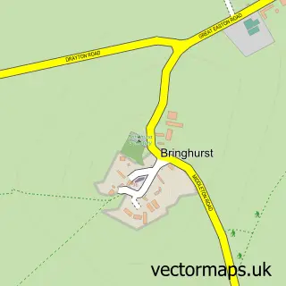
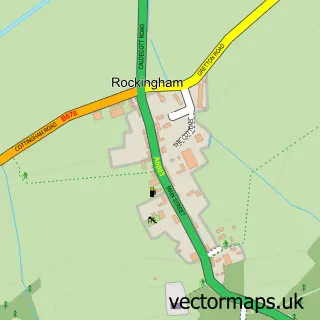
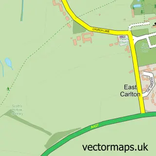
This Great Easton street map is a detailed vector street map covering a 750m x 750m area. Select a larger area to create and download your own vector street map of Great Easton.
The 750-metre map sample for Great Easton covers 303 mapped buildings and approximately 19.7 km of road detail, of which 23 named roads are named. The immediate area includes 1 pub. The wider area around Great Easton features 2 food and drink venues. To create a larger or custom map of Great Easton, the map builder lets you define your own coverage area and download editable SVG, PDF and PNG files.
Create a larger editable map of Great Easton
Choose any area you need and generate a high-quality vector map instantly. Perfect for print, planning, design, business and personal use.

This Great Easton street map in Leicestershire is available as downloadable SVG, PDF and PNG map files, or as a printed map for planning, business, display, education, local information and design work. You can also create a larger custom map area using the map selector.
What this Great Easton map sample shows
Great Easton lies within Great Easton Cp parish, part of Nevill ward in the Harborough District local authority area. The postcode geography for this area includes the LE postcode area, the LE16 postcode district and the LE16 8 postcode sector. Residents fall under the Nhs Leicester, Leicestershire And Rutland Integrated Care Board for NHS services.
Local features near Great Easton
Within 2 milesAmenities and services in and around Great Easton.
Administrative and postcode information for Great Easton
Great Easton lies within Great Easton Cp parish, part of Nevill ward in the Harborough District local authority area. The postcode geography for this area includes the LE postcode area, the LE16 postcode district and the LE16 8 postcode sector. Residents fall under the Nhs Leicester, Leicestershire And Rutland Integrated Care Board for NHS services.
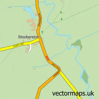
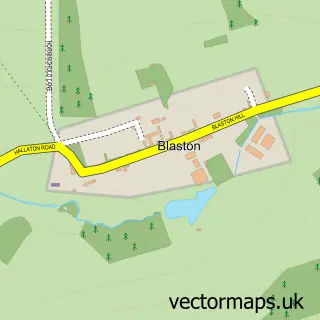
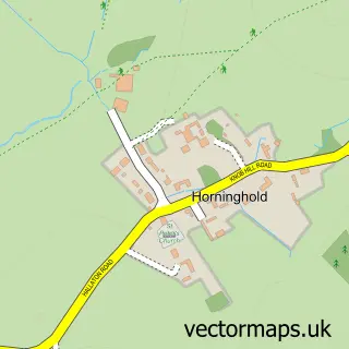
Nearby street map samples around Great Easton

More street maps in Leicestershire
750 metre map area coverage
Boundary, postcode and point of interest information for the 750m x 750m rectangle centred on this sample map.
Boundaries containing map centre
Constituency: Rutland and Stamford Co Const
County: Leicestershire County
District: Harborough District
Icb: NHS Leicester Leicestershire and Rutland ICB
Parish: Great Easton CP
Police Force: leicestershire
Postcode District: LE16
Postcode Sector: LE16 8
Ward: Nevill Ward
Nearby boundaries intersecting sample
Parish: Bringhurst CP
Postcode coverage
POI category counts
Liquor Store: 2
Pet Store: 2
Post Office: 2
Anglican Church: 1
Automotive Repair: 1
Clothing Store: 1
Coffee Shop: 1
Community Center: 1
Furniture Assembly: 1
Gardener: 1
Sample points of interest
- Great Easton: St Andrew
- DSG auto services
- Joules
- The Courtyard Pop Up
- Great Easton Village Hall
- The Sitting Room
- Blooming Gorgeous Gardens
- Gladstone Heating
- Tim's Tech Support
- Lottsofwine
- Viva Vino
- Eyebrook Wild Bird Feeds
Create a larger editable map of Great Easton
This sample shows only a 750 metre area. To create a larger map of Great Easton, use our map builder to choose your own coverage area, add titles and download editable SVG, PDF and PNG files.
Create a custom map of Great Easton