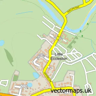
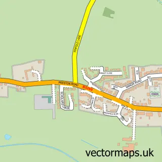
This Great Eccleston street map is a detailed vector street map covering a 750m x 750m area. Select a larger area to create and download your own vector street map of Great Eccleston.
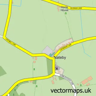
The 750-metre map sample for Great Eccleston covers 390 mapped buildings and approximately 14.5 km of road detail, of which 27 named roads are named. The immediate area includes 1 school, 1 GP surgery, 3 pubs and 2 MOT stations within 2 miles. The wider area around Great Eccleston features 5 food and drink venues and 1 hotel. To create a larger or custom map of Great Eccleston, the map builder lets you define your own coverage area and download editable SVG, PDF and PNG files.
Create a larger editable map of Great Eccleston
Choose any area you need and generate a high-quality vector map instantly. Perfect for print, planning, design, business and personal use.

This Great Eccleston street map in Lancashire is available as downloadable SVG, PDF and PNG map files, or as a printed map for planning, business, display, education, local information and design work. You can also create a larger custom map area using the map selector.
What this Great Eccleston map sample shows
Great Eccleston lies within Great Eccleston Cp parish, part of Great Eccleston ward in the Wyre District (B) local authority area. The postcode geography for this area includes the PR postcode area, the PR3 postcode district and the PR3 0 postcode sector. Residents fall under the Nhs Lancashire And South Cumbria Integrated Care Board for NHS services.
Local features near Great Eccleston
Within 2 milesAmenities and services in and around Great Eccleston.
Administrative and postcode information for Great Eccleston
Great Eccleston lies within Great Eccleston Cp parish, part of Great Eccleston ward in the Wyre District (B) local authority area. The postcode geography for this area includes the PR postcode area, the PR3 postcode district and the PR3 0 postcode sector. Residents fall under the Nhs Lancashire And South Cumbria Integrated Care Board for NHS services.
Nearby street map samples around Great Eccleston
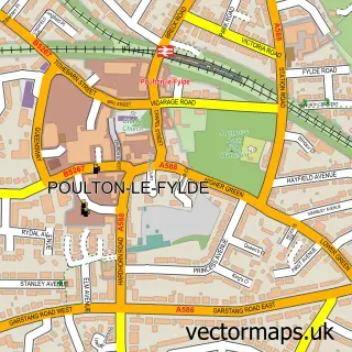

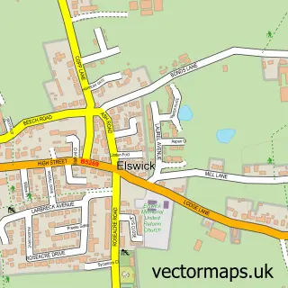
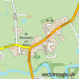
More street maps in Lancashire
750 metre map area coverage
Boundary, postcode and point of interest information for the 750m x 750m rectangle centred on this sample map.
Boundaries containing map centre
Constituency: Lancaster and Wyre Co Const
County: Lancashire County
District: Wyre District (B)
Icb: NHS Lancashire and South Cumbria ICB
Parish: Great Eccleston CP
Police Force: lancashire
Postcode District: PR3
Postcode Sector: PR3 0
Ward: Great Eccleston Ward
Nearby boundaries intersecting sample
Constituency: Fylde Co Const
District: Fylde District (B)
Parish: Little Eccleston-with-Larbreck CP
Ward: Rural North Fylde Ward
Postcode coverage
POI category counts
Convenience Store: 3
Pub: 3
Cafe: 2
Doctor: 2
Driving School: 2
Fish And Chips Restaurant: 2
Hair Salon: 2
Language School: 2
Pet Groomer: 2
Real Estate Agent: 2
Sample points of interest
- Northlands Village Rest Home
- The Mini Door Company
- Mini Door Co
- Pebby's Bakery
- Great Eccleston Barbers
- The Isolation Arms
- Courtyard Caffe
- The Courtyard Caffe And Bar
- Great Eccleston Village Centre
- Loco
- Nisa Local
- W Holden
Create a larger editable map of Great Eccleston
This sample shows only a 750 metre area. To create a larger map of Great Eccleston, use our map builder to choose your own coverage area, add titles and download editable SVG, PDF and PNG files.
Create a custom map of Great Eccleston