Vector Maps logo
Home Why it works Popular maps Districts Samples Customizer Create Your Map
VectorMaps.uk
Home Popular maps Districts Samples Customizer Create Your Map Privacy Disclaimer
Home / UK Maps / Northamptonshire / Grendon Map

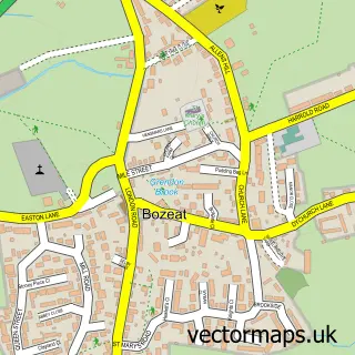
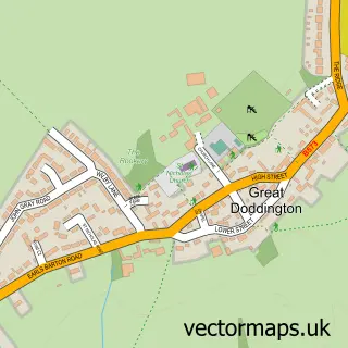
This Grendon street map is a detailed vector street map covering a 750m x 750m area. Select a larger area to create and download your own vector street map of Grendon.

Grendon is a village in Northamptonshire, in the East Midlands of England. The settlement falls within the Wellingborough parliamentary constituency. It is served by the NN7 postcode district, with NN7 1 as the local postcode sector.

The 750-metre map sample for Grendon covers 185 mapped buildings and approximately 23.0 km of road detail, of which 12 named roads are named. The immediate area includes 1 school and 1 MOT station within 2 miles. To create a larger or custom map of Grendon, the map builder lets you define your own coverage area and download editable SVG, PDF and PNG files.

185Buildings
22.99 kmRoads
12Named roads
1,223Residents within 2 miles
Create your own

Create a larger editable map of Grendon

Choose any area you need and generate a high-quality vector map instantly. Perfect for print, planning, design, business and personal use.

Choose any location
Editable SVG files
Any size up to A0
PDF, PNG & more
Instant download
High quality guaranteed
Create My Custom Map
Secure, private & no credit card required
Grendon Vector Street Map
750m Sample
Grendon vector street map sample showing roads, buildings and local features in a 750 metre preview area
Buy Grendon Map Print from £12.95 Buy Grendon Digital Map from £6

This Grendon street map in Northamptonshire is available as downloadable SVG, PDF and PNG map files, or as a printed map for planning, business, display, education, local information and design work. You can also create a larger custom map area using the map selector.

What this Grendon map sample shows

Grendon lies within Grendon Cp parish, part of Wollaston ward in the North Northamptonshire local authority area. The postcode geography for this area includes the NN postcode area, the NN7 postcode district and the NN7 1 postcode sector. Residents fall under the Nhs Northamptonshire Integrated Care Board for NHS services.

Local features near Grendon

Within 2 miles

Amenities and services in and around Grendon.

1 Schools
1 MOT stations within 2 miles

Counts are approximate and based on publicly available data.

Administrative and postcode information for Grendon

The local authority covering Grendon is North Northamptonshire, within the county of Northamptonshire. The settlement lies within Wollaston ward and Grendon Cp civil parish. The NN7 postcode district and NN7 1 postcode sector serve the immediate area. NHS provision in the area is delivered through Kettering General Hospital Nhs Foundation Trust.

Parish Grendon CP
Ward Wollaston
District / local authority North Northamptonshire
County Northamptonshire
Historic county Northamptonshire
Postcode district NN7
Postcode sector NN7 1
Parliamentary constituency Wellingborough
Region East Midlands
Country England

Nearby street map samples around Grendon

Street map sample of Wellingborough, Northamptonshire Wellingborough Town - Northamptonshire - 4.8 miles Street map sample of Milton Keynes, Buckinghamshire Milton Keynes City - Buckinghamshire - 13.5 miles Street map sample of Easton Maudit, Northamptonshire Easton Maudit Village - Northamptonshire - 1.1 miles Street map sample of Castle Ashby, Northamptonshire Castle Ashby Village - Northamptonshire - 1.2 miles Street map sample of Whiston, Northamptonshire Whiston Village - Northamptonshire - 1.8 miles Street map sample of Bozeat, Northamptonshire Bozeat Village - Northamptonshire - 1.9 miles Street map sample of Yardley Hastings, Northamptonshire Yardley Hastings Village - Northamptonshire - 2.3 miles Street map sample of Wollaston, Northamptonshire Wollaston Village - Northamptonshire - 2.3 miles Street map sample of Earls Barton, Northamptonshire Earls Barton Village - Northamptonshire - 2.6 miles Street map sample of Great Doddington, Northamptonshire Great Doddington Village - Northamptonshire - 2.8 miles

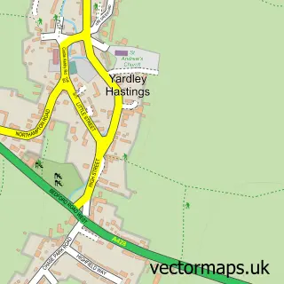
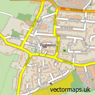
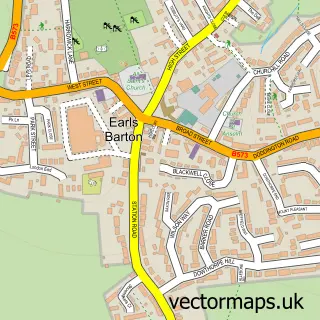
More street maps in Northamptonshire

Street map sample of Easton Maudit, Northamptonshire Easton Maudit Village - 1.1 miles Street map sample of Castle Ashby, Northamptonshire Castle Ashby Village - 1.2 miles Street map sample of Whiston, Northamptonshire Whiston Village - 1.8 miles Street map sample of Bozeat, Northamptonshire Bozeat Village - 1.9 miles Street map sample of Yardley Hastings, Northamptonshire Yardley Hastings Village - 2.3 miles

750 metre map area coverage

Boundary, postcode and point of interest information for the 750m x 750m rectangle centred on this sample map.

Boundaries containing map centre

Constituency: South Northamptonshire Co Const

District: North Northamptonshire

Icb: NHS Northamptonshire ICB

Parish: Grendon CP

Police Force: northamptonshire

Postcode District: NN7

Postcode Sector: NN7 1

Ward: Irchester Ward

Nearby boundaries intersecting sample

No additional intersecting boundaries found.

Postcode coverage

NN7 NN7 1

POI category counts

Anglican Church: 1

Beauty Salon: 1

Building Contractor: 1

Child Care And Day Care: 1

Christmas Trees: 1

Education: 1

Financial Service: 1

Flowers And Gifts Shop: 1

Language School: 1

Paintball: 1

Sample points of interest

  • St Mary's Grendon Anglican Church
  • The Lavender Beauty Barn Beauty Salon
  • Grendon Lakes Building Contractor
  • Little Giants Childcare Child Care And Day Care
  • Arborescence Tree Care Christmas Trees
  • Outdoor Learning Northamptonshire Education
  • Trumonix Financial Service
  • Eklectic Wonders Flowers And Gifts Shop
  • Fun French And Spanish - LCF Clubs - MARIA ALVES-AFONSO Language School
  • Go Ballistic Paintball
  • Arborescence Tree Care Tree Services

Create a larger editable map of Grendon

This sample shows only a 750 metre area. To create a larger map of Grendon, use our map builder to choose your own coverage area, add titles and download editable SVG, PDF and PNG files.

Create a custom map of Grendon

Phone 01751 473136 | Copyright Vectormaps.uk 2026

Samples Customizer Privacy Disclaimer
Grendon Vector Street Map
Grendon enlarged street map sample showing a 750 metre preview area