Vector Maps logo
Home Why it works Popular maps Districts Samples Customizer Create Your Map
VectorMaps.uk
Home Popular maps Districts Samples Customizer Create Your Map Privacy Disclaimer
Home / UK Maps / Greater Manchester / Hag Fold Map

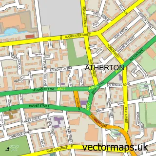
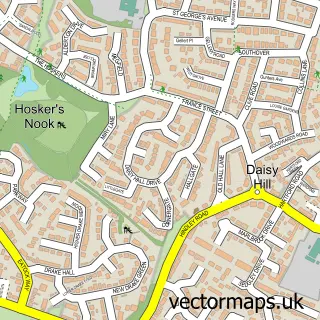
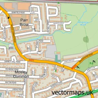
This Hag Fold street map is a detailed vector street map covering a 750m x 750m area. Select a larger area to create and download your own vector street map of Hag Fold.

Hag Fold is a village in Greater Manchester, in the North West of England. Historically, the area formed part of Lancashire. The settlement falls within the Bolton West parliamentary constituency. It is served by the M46 postcode district, with M46 0 as t

The 750-metre map sample for Hag Fold covers 594 mapped buildings and approximately 19.3 km of road detail, of which 46 named roads are named. The immediate area includes 3 schools, 2 GP surgeries, with 12 within 2 miles, 1 pub and 18 MOT stations within 2 miles. The wider area around Hag Fold features 3 food and drink venues and 1 hotel. To create a larger or custom map of Hag Fold, the map builder lets you define your own coverage area and download editable SVG, PDF and PNG files.

594Buildings
19.27 kmRoads
46Named roads
29,689Residents within 2 miles
Create your own

Create a larger editable map of Hag Fold

Choose any area you need and generate a high-quality vector map instantly. Perfect for print, planning, design, business and personal use.

Choose any location
Editable SVG files
Any size up to A0
PDF, PNG & more
Instant download
High quality guaranteed
Create My Custom Map
Secure, private & no credit card required
Hag Fold Vector Street Map
750m Sample
Hag Fold vector street map sample showing roads, buildings and local features in a 750 metre preview area
Buy Hag Fold Map Print from £12.95 Buy Hag Fold Digital Map from £6

This Hag Fold street map in Greater Manchester is available as downloadable SVG, PDF and PNG map files, or as a printed map for planning, business, display, education, local information and design work. You can also create a larger custom map area using the map selector.

What this Hag Fold map sample shows

Hag Fold lies within Wigan District (B) parish, part of Atherton ward in the Wigan District (B) local authority area. The postcode geography for this area includes the M postcode area, the M46 postcode district and the M46 0 postcode sector. Residents fall under the Nhs Greater Manchester Integrated Care Board for NHS services.

Local features near Hag Fold

Within 2 miles

Amenities and services in and around Hag Fold.

3 Schools
2 GP surgeries 12 within 2 miles
18 MOT stations within 2 miles
3 Food & drink
1 Pubs
1 Hotels
8 Healthcare POIs

Counts are approximate and based on publicly available data.

Administrative and postcode information for Hag Fold

Hag Fold lies within Wigan District (B) parish, part of Atherton ward in the Wigan District (B) local authority area. The postcode geography for this area includes the M postcode area, the M46 postcode district and the M46 0 postcode sector. Residents fall under the Nhs Greater Manchester Integrated Care Board for NHS services.

Parish WIGAN DISTRICT (B)
Ward Atherton
District / local authority Wigan District (B)
County Greater Manchester
Historic county Lancashire
Postcode district M46
Postcode sector M46 0
Parliamentary constituency Bolton West
Region North West
Country England

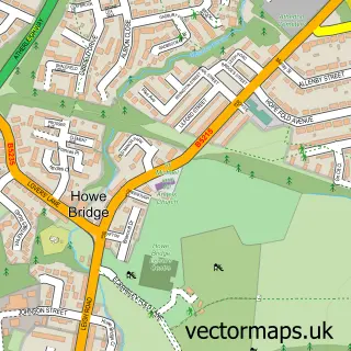
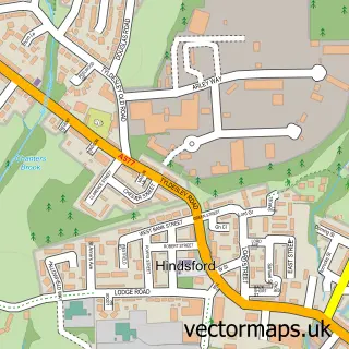
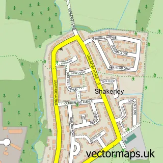
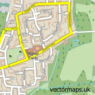
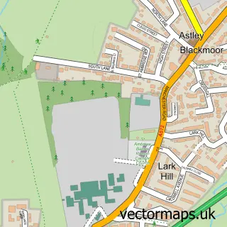
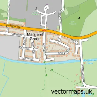
Nearby street map samples around Hag Fold

Street map sample of Atherton, Greater Manchester Atherton Town - Greater Manchester - 0.4 miles Street map sample of Salford, Greater Manchester Salford City - Greater Manchester - 9.0 miles Street map sample of Howe Bridge, Greater Manchester Howe Bridge Village - Greater Manchester - 0.9 miles Street map sample of Hindsford, Greater Manchester Hindsford Village - Greater Manchester - 1.1 miles Street map sample of Shakerley, Greater Manchester Shakerley Village - Greater Manchester - 1.2 miles Street map sample of Daisy Hill, Greater Manchester Daisy Hill Village - Greater Manchester - 1.3 miles Street map sample of Higher Folds, Greater Manchester Higher Folds Village - Greater Manchester - 1.9 miles Street map sample of Blackmoor, Greater Manchester Blackmoor Village - Greater Manchester - 2.6 miles Street map sample of Marsland Green, Greater Manchester Marsland Green Village - Greater Manchester - 2.7 miles Street map sample of Mosley Common, Greater Manchester Mosley Common Village - Greater Manchester - 3.1 miles

More street maps in Greater Manchester

Street map sample of Atherton, Greater Manchester Atherton Town - 0.4 miles Street map sample of Howe Bridge, Greater Manchester Howe Bridge Village - 0.9 miles Street map sample of Hindsford, Greater Manchester Hindsford Village - 1.1 miles Street map sample of Shakerley, Greater Manchester Shakerley Village - 1.2 miles Street map sample of Daisy Hill, Greater Manchester Daisy Hill Village - 1.3 miles

750 metre map area coverage

Boundary, postcode and point of interest information for the 750m x 750m rectangle centred on this sample map.

Boundaries containing map centre

Constituency: Leigh and Atherton Boro Const

District: Wigan District (B)

Icb: NHS Greater Manchester ICB

Police Force: greater manchester

Postcode District: M46

Postcode Sector: M46 0

Ward: Atherton North Ward

Nearby boundaries intersecting sample

Postcode Sector: M46 9

Postcode coverage

M46 M46 0 M46 9

POI category counts

Doctor: 4

Elementary School: 4

Fish And Chips Restaurant: 4

Convenience Store: 3

Atms: 2

Dentist: 2

Fast Food Restaurant: 2

Hospital: 2

Shopping: 2

Train Station: 2

Sample points of interest

  • St George Anglican Church
  • Morrisons Daily - Car Bank Street, Atherton Atms
  • PayPoint Atms
  • Smart Fix Uk Auto Body Shop
  • Fast Lane Transmissions Automotive
  • P R Panels Building Supply Store
  • St Josephs Workshop Business Office Supplies And Stationery
  • Quackers Cafe Cafe
  • Dorset Road Community Centre Community Center
  • Atherton Flapper Fold Lane Convenience Store
  • Costcutter Convenience Store
  • Go Local Extra Convenience Store

Create a larger editable map of Hag Fold

This sample shows only a 750 metre area. To create a larger map of Hag Fold, use our map builder to choose your own coverage area, add titles and download editable SVG, PDF and PNG files.

Create a custom map of Hag Fold

Phone 01751 473136 | Copyright Vectormaps.uk 2026

Samples Customizer Privacy Disclaimer
Hag Fold Vector Street Map
Hag Fold enlarged street map sample showing a 750 metre preview area