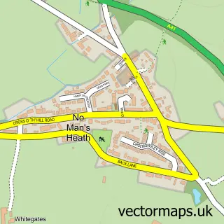
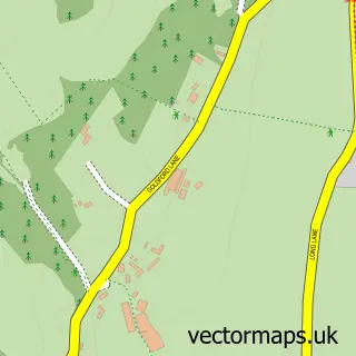
This Hampton Heath street map is a detailed vector street map covering a 750m x 750m area. Select a larger area to create and download your own vector street map of Hampton Heath.
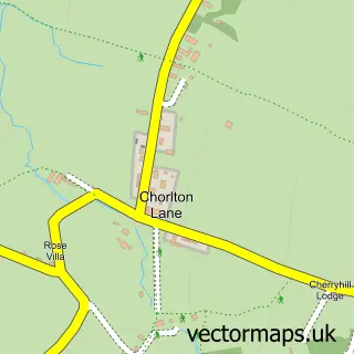
The 750-metre map sample for Hampton Heath covers 82 mapped buildings and approximately 10.3 km of road detail, of which 8 named roads are named. The immediate area includes 1 GP surgery within 2 miles. To create a larger or custom map of Hampton Heath, the map builder lets you define your own coverage area and download editable SVG, PDF and PNG files.
Create a larger editable map of Hampton Heath
Choose any area you need and generate a high-quality vector map instantly. Perfect for print, planning, design, business and personal use.

This Hampton Heath street map in Cheshire is available as downloadable SVG, PDF and PNG map files, or as a printed map for planning, business, display, education, local information and design work. You can also create a larger custom map area using the map selector.
What this Hampton Heath map sample shows
Hampton Heath lies within No Man's Heath And District Cp parish, part of Malpas ward in the Cheshire West And Chester (B) local authority area. The postcode geography for this area includes the SY postcode area, the SY14 postcode district and the SY14 8 postcode sector. Residents fall under the Nhs Cheshire And Merseyside Integrated Care Board for NHS services.
Local features near Hampton Heath
Within 2 milesAmenities and services in and around Hampton Heath.
Administrative and postcode information for Hampton Heath
Hampton Heath lies within No Man's Heath And District Cp parish, part of Malpas ward in the Cheshire West And Chester (B) local authority area. The postcode geography for this area includes the SY postcode area, the SY14 postcode district and the SY14 8 postcode sector. Residents fall under the Nhs Cheshire And Merseyside Integrated Care Board for NHS services.
Nearby street map samples around Hampton Heath

More street maps in Cheshire
750 metre map area coverage
Boundary, postcode and point of interest information for the 750m x 750m rectangle centred on this sample map.
Boundaries containing map centre
Constituency: Chester South and Eddisbury Co Const
District: Cheshire West and Chester (B)
Icb: NHS Cheshire and Merseyside ICB
Parish: No Man's Heath and District CP
Police Force: cheshire
Postcode District: SY14
Postcode Sector: SY14 8
Ward: Malpas Ward
Nearby boundaries intersecting sample
Parish: Malpas CP
Postcode coverage
POI category counts
Automotive Repair: 2
Business Manufacturing And Supply: 2
Cheese Shop: 2
Pet Store: 2
Veterinarian: 2
Building Supply Store: 1
Business Equipment And Supply: 1
Butcher Shop: 1
Construction Services: 1
Contractor: 1
Sample points of interest
- Charlton Motors
- Miles Macadam
- D Hassall Building Contractor
- Blue Loos Event Hire Ltd.
- Blue Loos Event Hire Ltd
- HJ Lea Oakes
- Malpas Farm Shop
- Reeces Creamery
- The Cheese Co
- Miles Macadam
- Barlows UK Ltd
- Athenbys
Create a larger editable map of Hampton Heath
This sample shows only a 750 metre area. To create a larger map of Hampton Heath, use our map builder to choose your own coverage area, add titles and download editable SVG, PDF and PNG files.
Create a custom map of Hampton Heath