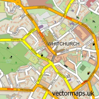
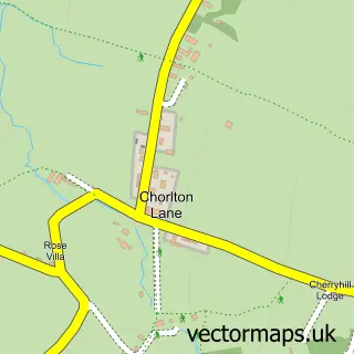
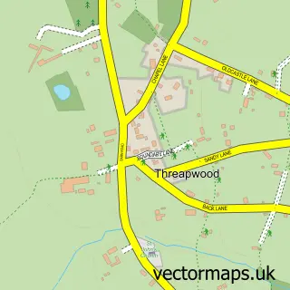
This Malpas street map is a detailed vector street map covering a 750m x 750m area. Select a larger area to create and download your own vector street map of Malpas.
The 750-metre map sample for Malpas covers 428 mapped buildings and approximately 16.0 km of road detail, of which 29 named roads are named. The immediate area includes 1 school, 1 GP surgery within 2 miles and 3 pubs. The wider area around Malpas features 2 tourism points of interest, 10 food and drink venues and 3 hotels. To create a larger or custom map of Malpas, the map builder lets you define your own coverage area and download editable SVG, PDF and PNG files.
Create a larger editable map of Malpas
Choose any area you need and generate a high-quality vector map instantly. Perfect for print, planning, design, business and personal use.

This Malpas street map in Cheshire is available as downloadable SVG, PDF and PNG map files, or as a printed map for planning, business, display, education, local information and design work. You can also create a larger custom map area using the map selector.
What this Malpas map sample shows
Malpas lies within Malpas Cp parish, part of Malpas ward in the Cheshire West And Chester (B) local authority area. The postcode geography for this area includes the SY postcode area, the SY14 postcode district and the SY14 8 postcode sector. Residents fall under the Nhs Cheshire And Merseyside Integrated Care Board for NHS services.
Local features near Malpas
Within 2 milesAmenities and services in and around Malpas.
Administrative and postcode information for Malpas
Malpas lies within Malpas Cp parish, part of Malpas ward in the Cheshire West And Chester (B) local authority area. The postcode geography for this area includes the SY postcode area, the SY14 postcode district and the SY14 8 postcode sector. Residents fall under the Nhs Cheshire And Merseyside Integrated Care Board for NHS services.
Nearby street map samples around Malpas

More street maps in Cheshire
750 metre map area coverage
Boundary, postcode and point of interest information for the 750m x 750m rectangle centred on this sample map.
Boundaries containing map centre
Constituency: Chester South and Eddisbury Co Const
District: Cheshire West and Chester (B)
Icb: NHS Cheshire and Merseyside ICB
Parish: Malpas CP
Police Force: cheshire
Postcode District: SY14
Postcode Sector: SY14 8
Ward: Malpas Ward
Nearby boundaries intersecting sample
Postcode Sector: SY14 7
Postcode coverage
POI category counts
Hotel: 3
Pub: 3
Restaurant: 3
Bakery: 2
Beauty And Spa: 2
Beauty Salon: 2
Cafe: 2
Church Cathedral: 2
Coffee Shop: 2
Elementary School: 2
Sample points of interest
- St Oswald's, Malpas
- No. 25
- Brass Monkees
- CV Cakes
- Huxley's
- Lloyds Bank
- Banking Hub
- My Father's Moustache
- Quintessence Beauty Salon
- The Cutting Room
- Georgie & Co. Beauty
- Strands Hairdressing
Create a larger editable map of Malpas
This sample shows only a 750 metre area. To create a larger map of Malpas, use our map builder to choose your own coverage area, add titles and download editable SVG, PDF and PNG files.
Create a custom map of Malpas